Russellville in Hamblen County, Tennessee — The American South (East South Central)
Longstreet's Headquarters
A Cold Command
Inscription.
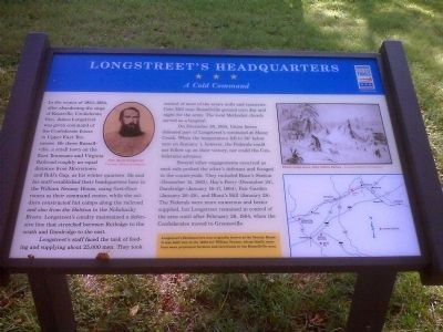
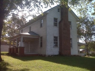
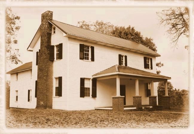
In the winter of 1863-1864, after abandoning the siege of Knoxville, Confederate Gen. James Longstreet was given command of the Confederate forces in Upper East Tennessee. He chose Russellville, a small town on the East Tennessee and Virginia Railroad roughly an equal distance from Morristown and Bull's Gap, as his winter quarters. He and his staff established their headquarters here in the William Nenney House, using first-floor rooms as their command center, while the soldiers constructed hut camps along the railroad and also from the Holston to the Nolichucky Rivers. Longstreet's cavalry maintained a defensive line that stretched between Rutledge to the south and Dandridge to the east.
Longstreet's staff faced the task of feeding and supplying about 25,000 men. They took control of most of the area's mills and tanneries. Cain Mill near Russellville ground corn day and night for the army. The local Methodist church served as a hospital.
On December 29, 1863, Union forces defeated part of Longstreet's command at Mossy Creek. When the temperature fell to 24° below zero on January 1, however, the Federals could not follow up on their victory, nor could the Confederates advance.
Several other engagements occurred as each side probed the other's defenses and foraged in the countryside. They included Bean's Station (December 14, 1863), Hay's Ferry (December 24), Dandridge (January 16-17, 1864), Fair Garden (January 26-28), and Blant's Hill (January 28). The Federals were more numerous and better supplied, but Longstreet remained in control of the area until after February 26, 1864, when the Confederates moved to Greeneville.
Longstreet's Headquarters was originally known as the Nenney House. It was built late in the 1830s for William Nenney, whose family members were prominent farmers and merchantes in the Russellville area.
Erected 2010 by Tennessee Civil War Trails.
Topics and series. This historical marker is listed in this topic list: War, US Civil. In addition, it is included in the Tennessee Civil War Trails series list. A significant historical month for this entry is January 1785.
Location. 36° 15.441′ N, 83° 11.749′ W. Marker is in Russellville, Tennessee, in Hamblen County. Marker is on Andrew Johnson Highway (U.S. 11E), on the right when traveling north. At the northeast side of the house near end of driveway. Touch for map. Marker is in this post office area: Russellville TN 37860, United States of America. Touch for directions.
Other nearby markers. At least 8 other markers are within 3 miles of this marker, measured as the crow flies. Longstreet's Billet (within shouting distance of this marker); Hayslope (approx. ¼ mile away); Cheek's Crossroads (approx. one mile away); Coffman House
(approx. 1.2 miles away); Bethesda Presbyterian Church (approx. 1.9 miles away); Russellville Area (approx. 1.9 miles away); Tidence Lane (approx. 3 miles away); Bent Creek Baptist Church (approx. 3 miles away). Touch for a list and map of all markers in Russellville.
More about this marker. On the right side of the marker is a Winter camp scene, 1863, Edwin Forbes and a map showing nearby Civil War Trails sites. On the left is a portrait of General Longstreet.
Regarding Longstreet's Headquarters. House was recently purchased by the Lakeway Civil War Preservation Association and will be turned into a museum.
Related marker. Click here for another marker that is related to this marker. State historical marker about house.
Credits. This page was last revised on June 16, 2016. It was originally submitted on September 12, 2010, by Bill Porter of Cumberland Gap, Tennessee. This page has been viewed 2,403 times since then and 40 times this year. Last updated on March 17, 2015, by J. Makali Bruton of Accra, Ghana. Photos: 1, 2. submitted on September 12, 2010, by Bill Porter of Cumberland Gap, Tennessee. 3. submitted on October 13, 2011, by Marty Carson of Morristown, Tennessee. • Bill Pfingsten was the editor who published this page.


