North Brainerd in Chattanooga in Hamilton County, Tennessee — The American South (East South Central)
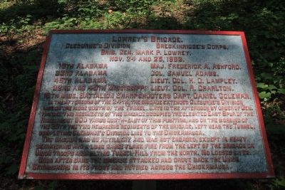
Lowrey's Brigade
Cleburne's Division - Breckinridge's Corps.
— Brig. Gen. Mark P. Lowrey. —
Cleburne's Division - Breckinridge's Corps.
Brig. Gen. Mark P. Lowrey.
Nov. 24 and 25, 1863.
16th Alabama - Maj. Frederick A. Ashford.
33rd Alabama - Col. Samuel Adams.
45th Alabama - Lieut. Col. M.O. Lampley.
32nd and 45th Mississippi - Lieut. Col. A. Charlton.
15th Miss. Battalion Sharpshooters - Capt. Daniel Coleman.
In the afternoon of the 24th, the Brigade extended Cleburne's Division line on the ridge south of the Tunnel. Late in the afternoon by order of Gen. Hardee, two regiments of the Brigade occupied the elevated East Spur of the Ridge about 800 yards north-east of this position, and on the morning of the 25th the two remaining regiments of the Brigade, left near the Tunnel, completing Cleburne's Division line to the Chickamauga.
The Brigade had no artillery and was not engaged, except in heavy skirmishing and a long range flank fire from the left of the Brigade on Union troops assaulting Tunnel Hill from the north. No losses given.
Soon after dark the Brigade attacked and drove back the Union Skirmishers in its front and retired across the Chickamauga.
Erected 1890 by the Chickamauga-Chattanooga National Battlefield Commission. (Marker Number MT-377.)
Topics and series. This historical marker is listed in this topic list: War, US Civil. In addition, it is included in the Chickamauga and Chattanooga National Military Park, Sherman Reservation, and the Chickamauga and Chattanooga National Military Park: November 25, 1863 series lists. A significant historical month for this entry is October 1863.
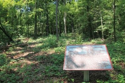
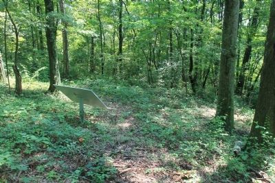
Location. 35° 4.258′ N, 85° 14.274′ W. Marker is in Chattanooga, Tennessee, in Hamilton County. It is in North Brainerd. Marker can be reached from North Crest Road north of Lightfoot Mill Road. This historic marker is located in the Sherman Reservation, up on the hill called the "Sherman Heights," and is situated near the base of a trail that goes off into the woods, and down the side of the hill, from the east side of the clearing on the top of the "Sherman Heights". Touch for map. Marker is in this post office area: Chattanooga TN 37404, United States of America. Touch for directions.
Other nearby markers. At least 8 other markers are within walking distance of this marker. 47th Ohio Infantry (within shouting distance of this marker); 54th Ohio Infantry (within shouting distance of this marker); Ewing's Division (about 300 feet away, measured in a direct line); 37th Ohio Infantry (about 300 feet away); Earthworks (about 400 feet away); Lightburn's Brigade (about 400 feet
away); Giles A. Smith's Brigade (about 400 feet away); 30th Ohio Infantry (about 400 feet away). Touch for a list and map of all markers in Chattanooga.
More about this marker. Because of its location in the Sherman Reservation it cannot be reached by car and can only be reached by foot. I would suggest parking your car in the provided parking area on Lightfoot Mill Road and then walking north on North Crest Road. You will reach a spot on this road where there is a locked gate barring further vehicle traffic on the road, but not foot traffic. Continue to walk all the way to the end of North Crest Road. Once there you will see a pathway that goes from the end of the road to the center of the gorge that separates "Tunnel Hill" to your south and "Sherman Heights" to your north. This historic marker is to the north on the "Sherman Heights."
Credits. This page was last revised on February 7, 2023. It was originally submitted on August 8, 2012, by Dale K. Benington of Toledo, Ohio. This page has been viewed 679 times since then and 27 times this year. Last updated on March 18, 2015, by J. Makali Bruton of Accra, Ghana. Photos: 1, 2, 3. submitted on August 9, 2012, by Dale K. Benington of Toledo, Ohio. • Bill Pfingsten was the editor who published this page.


