Near Elizabethtown in Hamilton County, Ohio — The American Midwest (Great Lakes)
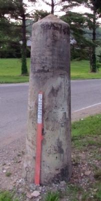
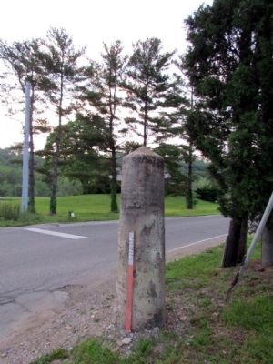
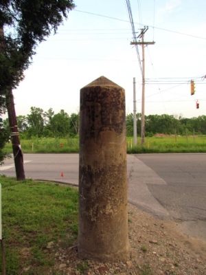
Indiana - Ohio State Line Monument
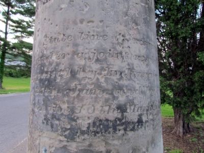
(South Face)
State Line as resurveyed under a joint resolution passed by Indiana on the 27th Jan. and by Ohio on the 10th March 1837.
(East Face)
Ohio
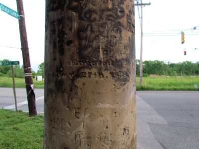
(North Face)
Erected Nov. 27th, 1838.
(West Face)
Indiana
Erected 1838.
Topics. This historical marker and monument is listed in this topic list: Political Subdivisions. A significant historical date for this entry is March 10, 1837.
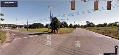
Location. 39° 8.955′ N, 84° 49.211′ W. Marker has been reported damaged. Marker is near Elizabethtown, Ohio, in Hamilton County. Marker is at the intersection of Louisville Pike (U.S. 50) and State Line Road, on the right when traveling west on Louisville Pike. Marker is located at the northeast corner of the intersection. This marker was damaged when a semi trailer knocked it over in the summer of 2021. The marker was cracked in half and there are no plans (that I know of) to replace it. Touch for map. Marker is in this post office area: North Bend OH 45052, United States of America. Touch for directions.
Other nearby markers. At least 8 other markers are within 4 miles of this location, measured as the crow flies. 1801 Miller Burying Ground (approx. 0.6 miles away in Indiana); Miami Fort / Fort Finney (approx. 2.3 miles away); Fort Finney (approx. 2.3 miles away); Point Farm (approx. 2.3 miles away); John Cleves Symmes (approx. 3.6 miles away); Abraham Brower (approx. 3.6 miles away); Mill Stone (approx. 3.6 miles away); Congress Green Cemetery / The Miami Purchase (approx. 3.6 miles away).
More about this monument. According to the Hamilton County Engineer's Office, the monument is a tapered cylindrical shaft of fine-grain sandstone. It is nine feet long and weighs 5,000 pounds. On October 11, 1929, the Col. Archibald Lochry chapter of the Daughters of the American Revolution placed a bronze tablet to the south face of the monument, but the tablet is now missing.
Credits. This page was last revised on April 4, 2023. It was originally submitted on March 20, 2015, by Duane Hall of Abilene, Texas. This page has been viewed 762 times since then and 51 times this year. Last updated on April 3, 2023, by John Gehlenborg of Lawrenceburg, Indiana. Photos: 1, 2, 3, 4, 5, 6. submitted on March 20, 2015, by Duane Hall of Abilene, Texas. • Devry Becker Jones was the editor who published this page.
