Samoa in Humboldt County, California — The American West (Pacific Coastal)
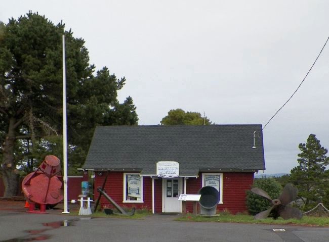
Humboldt Bay Maritime Museum
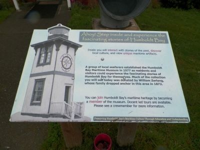
Ahoy! Step inside and experience the
fascinating stories of Humboldt Bay
Inside you will interact with stories of the past, discover local culture, and view unique maritime artifacts
A group of local seafarers established the Humboldt Bay Maritime Museum in 1977 so residents and visitors could experience the fascinating stories of Humboldt Bay for themselves. Much of the collection you will see today was donated by William Zerlang, whose family dropped anchor in this area in 1872.
You can join Humboldt Bay's maritime heritage by becoming a member of the museum. Docent led tours are available. Please see a crewmember for more information.
Preserving Humboldt Bay's Maritime Culture Through Education and Understanding
Topics. This historical marker is listed in these topic lists: Education • Industry & Commerce • Waterways & Vessels. A significant historical year for this entry is 1977.
Location. 40° 49.204′ N, 124° 10.898′ W. Marker is in Samoa, California, in Humboldt County. Marker is on Cookhouse Road, on the right when traveling north. Although the address of the museum is on Cookhouse Road, this marker is in the parking lot of the Samoa Cookhouse on North Bay View Avenue. Touch for map. Marker is at or near this postal address: 77 Cookhouse Road, Samoa CA 95564, United States of America. Touch for directions.
Other nearby markers. At least 8 other markers are within 2 miles of this marker, measured as the crow flies. Bar Tug Ranger (here, next to this marker); Samoa Cookhouse Circa 1893 (within shouting distance of this marker); Indian/Gunther Island Site 67 (Tolowot) (approx. 1.1 miles away); Madaket Plaza (approx. 1.2 miles away); Eagle House (approx. 1.3 miles away); Buhne General Store (approx. 1.3 miles away); E. Janssen Building (approx. 1.3 miles away); The former Fairwind (approx. 1.3 miles away). Touch for a list and map of all markers in Samoa.
Also see . . .
1. Humboldt Bay Maritime Museum. Museum website homepage (Submitted on March 22, 2015, by James King of San Miguel, California.)
2. Historic Humboldt Bay. Humboldt Bay Harbor District website entry:
"...Humboldt Bay was finally "discovered" in 1806 by an exploration party from the O'Cain - a vessel jointly commissioned by the Winship brothers from Boston and the Russian-American Fur Company. However, the O'Cain's mission to hunt sea otters soon ended and the ship sailed out of Humboldt Bay, with no one on board documenting the bay's location on a map. The location of the bay's entrance, hidden among rocky cliffs and sand dunes, once again became a mystery!
The search for Humboldt Bay was renewed during the early years of the California
Gold Rush. The discovery of gold in the Trinity region of Northern California in 1848 caused a population explosion in Humboldt County. The explorers, traders and trappers, who had come seeking adventure and wealth, now gave way to miners seeking gold and settlers anxious to claim the rich farmlands. Companies that supplied interior mining settlements began looking for coastal supply ports as alternatives to the slow and expensive overland Sacramento Valley route then in use..." (Submitted on March 23, 2015, by James King of San Miguel, California.)
3. Discovery of Humboldt Bay, California - 1806. Fort Ross Conservancy Library PDF (Submitted on March 23, 2015, by James King of San Miguel, California.)
Credits. This page was last revised on July 27, 2021. It was originally submitted on March 22, 2015, by James King of San Miguel, California. This page has been viewed 328 times since then and 11 times this year. Photos: 1, 2, 3, 4. submitted on March 22, 2015, by James King of San Miguel, California. • Syd Whittle was the editor who published this page.


