Near Hondo in Medina County, Texas — The American South (West South Central)
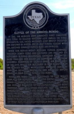
Battle of the Arroyo Hondo
When Gen. Adrian Woll's Mexican forces advanced through South Texas and captured San Antonio on September 11, Texan volunteers gathered for battle. More than 200 men under the command of Matthew Caldwell assembled at Salado Creek six miles east of the city, where on September 18 they fought with the Mexican Cavalry. With losses on both sides, the Mexicans returned briefly to San Antonio before beginning their march toward the border.
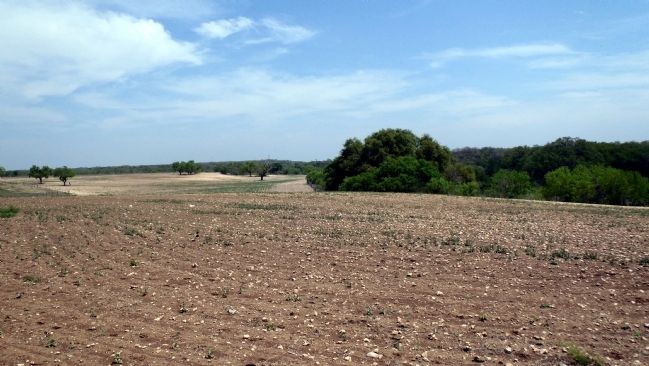
Additional Texan forces marshaled to meet Woll's Army, and on September 21 another battle occurred at Hondo Creek (Arroyo Hondo) near this site. Although Texan and Mexican accounts of the engagement varied considerably, reliable sources indicate that the Texans, plagued by dissension and a lack of clear leadership, failed in their attempt to rout the Mexican forces. The Mexicans returned home and the Texas government, in response to the 1842 invasions, mounted the ill-fated Somervell Expedition later that year.
Erected 1992 by Texas Historical Commission. (Marker Number 332.)
Topics and series. This historical marker is listed in this topic list: War, Texas Independence. In addition, it is included in the San Antonio-El Paso Road series list. A significant historical month for this entry is September 1834.
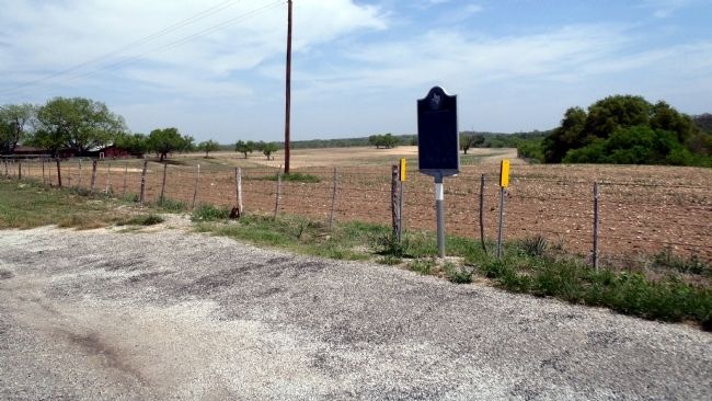
Location. 29° 25.241′ N, 99° 10.773′ W. Marker is near Hondo, Texas, in Medina County. Marker is on Farm to Market Road 462, 6˝ miles north of U.S. 90, on the right when traveling north. Touch for map. Marker is in this post office area: Hondo TX 78861, United States of America. Touch for directions.
Other nearby markers. At least 8 other markers are within 6 miles of this marker, measured as the crow flies. Mission Valley (approx. 3˝ miles away); Vandenburg (approx. 3.8 miles away); Hondo Army Air Field (approx. 4.4 miles away); a different marker also named Hondo Army Air Field (approx. 4.4 miles away); Southern Pacific Depot (approx. 5.3 miles away); Old Medina County Jail (approx. 5.4 miles away); Stephen F. Austin Memorial Oak Tree (approx. 5.4 miles away); Medina County Courthouse (approx. 5.4 miles away). Touch for a list and map of all markers in Hondo.
Regarding Battle of the Arroyo Hondo. Excerpt from a letter sent to the “Spirit of the Times” newspaper by Brevet Major W.S. Henry, 3rd U.S. Infantry, with the Great Government Train creating the “lower road” from San Antonio to El Paso: June 7, 1849
“We encamped on the battle ground of the Hondo — a battle field belonging to Texas before her lone star was mingled with the others of liberty. It was an affair between a party of Texans, and the retreating Mexican army, under General Woll. The latter as usual “vamoosed,” leaving much of their camp equipage and means of transportation scattered over the ground. Remnants of these articles are visible.”
Credits. This page was last revised on June 16, 2016. It was originally submitted on April 17, 2013, by William F Haenn of Fort Clark (Brackettville), Texas. This page has been viewed 1,716 times since then and 111 times this year. Last updated on March 24, 2015, by J. Makali Bruton of Accra, Ghana. Photos: 1, 2, 3. submitted on April 17, 2013, by William F Haenn of Fort Clark (Brackettville), Texas. • Bernard Fisher was the editor who published this page.


