Norden in Nevada County, California — The American West (Pacific Coastal)
Transcontinental Railroad
Hwy 40 Scenic Bypass
History
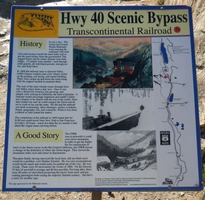
It was a race. The Union and Central Pacific Railroads were crossing the continent with steel rails each trying to build the most miles and so get the most money from the government. The rugged Sierra and its winter climate were challenges. 15 tunnels were needed - each through solid granite, all with black powder, nitroglycerine, and hand labor.
In 1866 the railroad came to Summit Valley. 8,000 Chinese workers and a few whites, toiled on the grading, rail laying, and tunnel building. There were camps up and down the route along with the support needed to maintain them.
The wail of the train whistle comes through Summit Valley many times a day now. Once it was only a dream but America was growing, and people would come to California, the land of promise. A railroad would encourage migration and enable California’s bounty to be shared with the rest of the world. Theodore Judah was sure he could conquer the Sierra and he set to work to lay out the route. He did and the railroad was built overcoming labor shortages, strikes, accidents, floods, geography, fire and avalanche. When it was done, a ribbon of steel joined the nation.
The completion of the railroad in 1869 meant that for $140 you could travel from New York to San Francisco in 6 days, 20 hours - much less than the six months it had taken the wagon trains not long before.
A Good Story
The CPRR was so powerful it could even move mountains. In order to get the higher fee for construction of track in the Sierra versus in the flat Central California, the CPRR forced a change in the definition of where the Sierra began. They moved the mountains miles west and closer to Sacramento.
Theodore Judah, having surveyed the local trees, did not think snow would be a problem over Donner Summit. He was sure accumulations would not be much and could easily be pushed out of the way. He was wrong. There were 44 snowstorms the winter of 1866. On the Summit 35 feet of snowfall is average and 60 feet possible. Not long after, there were 40 miles of snowsheds protecting the tracks and preventing passengers from seeing the majestic Summit scenery… but that’s a story for another sign.
Erected by Donner Summit Historical Society. (Marker Number 29.)
Topics and series. This historical marker is listed in this topic list: Railroads & Streetcars. In addition, it is included in the Donner Summit Historical Society, the Nevada - 20-Mile Museum - Hwy 40 Scenic Bypass, and the Transcontinental Railroad series lists. A significant historical year for this entry is 1866.
Location. 39° 19.114′ N, 120°
19.113′ W. Marker is in Norden, California, in Nevada County. Marker is on Donner Pass Road, on the left when traveling east. Touch for map. Marker is in this post office area: Norden CA 95724, United States of America. Touch for directions.
Other nearby markers. At least 8 other markers are within walking distance of this marker. McGlashan Point (here, next to this marker); Donner Pass (here, next to this marker); Stephens – Townsend – Murphy Party of 1844 (within shouting distance of this marker); Donner Summit Overlook (within shouting distance of this marker); Rainbow Bridge (about 300 feet away, measured in a direct line); Donner Summit Bridge (about 300 feet away); China Wall (about 700 feet away); Petroglyphs (about 700 feet away). Touch for a list and map of all markers in Norden.
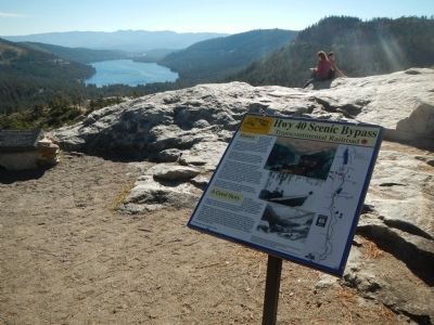
More about this marker. This marker is located at the Donner Lake Overlook on Old Highway 40.
Regarding Transcontinental Railroad. This marker is removed every Fall for the winter months and replaced every Spring for the summer season.
Also see . . . The 20-Mile Museum Brochure. Information and the listing of all the markers within this series. (Submitted on March 28, 2015.)
Credits. This page was last revised on June 16, 2016. It was originally submitted on March 24, 2015, by Barry Swackhamer of Brentwood, California. This page has been viewed 529 times since then and 25 times this year. Photos: 1, 2, 3. submitted on March 24, 2015, by Barry Swackhamer of Brentwood, California. • Syd Whittle was the editor who published this page.


