Norden in Nevada County, California — The American West (Pacific Coastal)
Petroglyphs
Hwy 40 Scenic Bypass
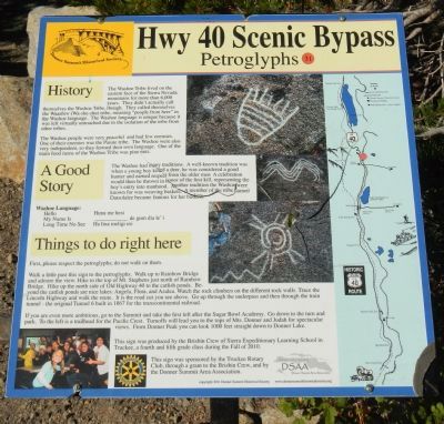
History
The Washoe Tribe lived on the eastern face of the Sierra Nevada mountains for more than 6,000 years. They didn’t actually call themselves the Washoe Tribe, though. They called themselves the Waashiw (Wa-she-shu) tribe, meaning “people from here” in the Washoe language. The Washoe language is unique because it was left virtually untouched due to the isolation of the tribe from other tribes.
The Washoe people were very peaceful and had few enemies. One of their enemies was the Paiute tribe. The Washoe were also very independent, so they formed their own language. One of the main food items of the Washoe Tribe was pine nuts.
A Good Story
The Washoe had many traditions. A well-known tradition was when a young boy killed a deer, he was considered a good hunter and earned respect from the older men. A celebration would then be thrown in honor of the first kill, representing the boy’s entry into manhood. Another tradition the Washoe were known for was weaving baskets. A member of the tribe named Datsolalee became famous for her baskets.
Washoe Language:
Hello — Huna me hesibr
My Name Is — _______ de gum dia le’i
Long Time No See — Ha lina meligi esi
Things to do right here
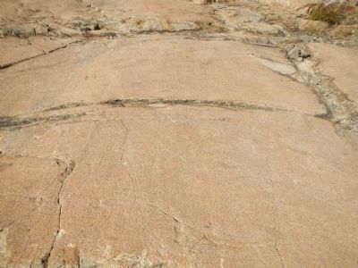
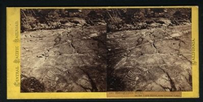
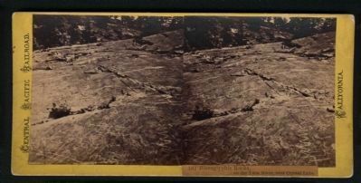
First, please respect the petroglyphs; do not walk on them.
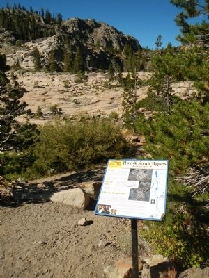
Walk a little past this sign to the petroglyphs. Walk up to the Rainbow Bridge and admire the view. Hike to the top of Mt. Stephens just north of Rainbow Bridge. Hike up the north side of Old Highway 40 to the catfish ponds. Beyond the catfish ponds are nice lakes: Angela, Flora, and Azalea. Watch the rock climbers on the different rock walls. Trace the Lincoln Highway and walk the route. It is the road cut you see above. Go up through the underpass and then through the train tunnel - the original Tunnel 6 built in 1867 for the transcontinental railroad.
If you are more ambitious, go to the Summit and take the first left after the Sugar Bowl Academy. Go down to the turn and park. To the left is a trailhead for the Pacific Crest. Turnoffs will lead you to the tops of Mts. Donner and Judah for spectacular views. From Donner Peak you can look 1000 feet straight down to Donner Lake.
This sign was produced by the Brisbin Crew of Sierra Expeditionary Learning School in Truckee, a fourth and fifth grade class during the Fall of 2010.
Erected by Donner Summit Historical Society. (Marker Number 31.)
Topics and series. This historical marker is listed in this topic list: Native Americans. In addition, it is included in the Donner Summit Historical Society, and the Nevada - 20-Mile Museum - Hwy 40 Scenic Bypass series lists. A significant historical year for this entry is 1867.
Location. 39° 19.056′ N, 120° 19.232′ W. Marker is in Norden, California, in Nevada County. Marker is on Donner Pass Road, on the left when traveling east. This marker is located on Old Highway 40 on the east side of Donner Summit. Touch for map. Marker is in this post office area: Norden CA 95724, United States of America. Touch for directions.
Other nearby markers. At least 8 other markers are within walking distance of this marker. China Wall (a few steps from this marker); Sacred Symbols From Ancient Times (within shouting distance of this marker); China Wall of the Sierra (about 400 feet away, measured in a direct line); Rainbow Bridge (about 500 feet away); Stephens – Townsend – Murphy Party of 1844 (about 600 feet away); Donner Pass (about 600 feet away); McGlashan Point (about 700 feet away); Transcontinental Railroad (about 700 feet away). Touch for a list and map of all markers in Norden.
More about this marker. This marker is removed every Fall for the winter months and replaced every Spring for the summer season.
Related marker. Click here for another marker that is related to this marker. A Nevada State marker commemorating Dat So La Lee
Also see . . . The 20-Mile Museum Brochure. Information and the listing of all the markers within this series. (Submitted on March 28, 2015.)
Credits. This page was last revised on November 6, 2020. It was originally submitted on March 24, 2015, by Barry Swackhamer of Brentwood, California. This page has been viewed 648 times since then and 29 times this year. Photos: 1, 2, 3, 4, 5. submitted on March 24, 2015, by Barry Swackhamer of Brentwood, California. • Syd Whittle was the editor who published this page.
