Waterloo in Seneca County, New York — The American Northeast (Mid-Atlantic)
General Sullivanís New York Campaign Trail
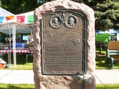
General John Sullivan
and
General James Clinton
1779
An expedition against the hostile Indian nations which checked the aggression of the English and Indians on the frontiers of New York and Pennsylvania, extending westward the dominion of the United States
Erected 1929 by State of New York.
Topics and series. This historical marker is listed in these topic lists: Native Americans • War, US Revolutionary • Wars, US Indian. In addition, it is included in the The Sullivan-Clinton Expedition Against the Iroquois Indians series list. A significant historical year for this entry is 1779.
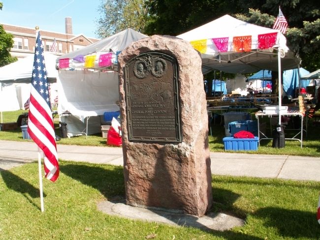
Location. 42° 54.275′ N, 76° 52.013′ W. Marker is in Waterloo, New York, in Seneca County. Marker is on West Main Street (U.S. 20) 0.1 miles west of Park Place, on the right when traveling west. This marker is located in Lafayette Park. Touch for map. Marker is in this post office area: Waterloo NY 13165, United States of America. Touch for directions.
Other nearby markers. At least 8 other markers are within walking distance of this marker. Korean Veterans Memorial (within shouting distance of this marker); Memorial Day (within shouting distance of this marker); Sampson Naval Training Station Veterans (within shouting distance of this marker); Lafayetteís Tour (within shouting distance of this marker); General Lafayette (within shouting distance of this marker); War Memorial (within shouting distance of this marker); Celebrating 100 Years of High School Education in Waterloo (within shouting distance of this marker); General Murray Residence (within shouting distance of this marker). Touch for a list and map of all markers in Waterloo.
More about this marker. At the top of the marker are the likenesses of Generals Clinton and Sullivan. Below these portraits is a map of the routes taken by the armies of Generals John Sullivan and James Clinton in 1779.
Regarding General Sullivanís New York Campaign Trail. This marker is part of the General John Sullivanís New York Campaign trail. Twenty-nine such highway markers were commissioned by New York State in 1929 (the 150th anniversary) to mark the 1779 invasion route.
Also see . . .
1. The Sullivan-Clinton Campaign, Then and Now. The Sullivan-Clinton Campaign of 1779 was the largest expedition ever before mounted against the Indians of North America. (Submitted on June 7, 2008, by Bryan Olson of Syracuse, New York.)
2. Wikipedia entry for the Sullivan Expedition. Wikipedia gives a lot of good detailed information on the Sullivan Expedition (Submitted on June 7, 2008, by Bryan Olson of Syracuse, New York.)
Credits. This page was last revised on June 16, 2016. It was originally submitted on June 7, 2008, by Bryan Olson of Syracuse, New York. This page has been viewed 2,039 times since then and 48 times this year. Photos: 1, 2. submitted on June 7, 2008, by Bryan Olson of Syracuse, New York. • Christopher Busta-Peck was the editor who published this page.

