Yosemite National Park in Mariposa County, California — The American West (Pacific Coastal)
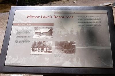
Mirror Lake Resources
Inscription.
For centuries, the local Indians use the bracken fern found above Mirror Lake. In the 1800s, Euro-American entrepreneurs found new uses for the area's resources. Hotel owners marketed the magnificent scenery to an enthusiastic audience or travelers. The lakes ice and eventually its sand were harvested as well.
Ice and Sand
Yosemite's early hotel industry responded to increasing tourism by providing diverse services for guests. The harvesting of ice from Mirror Lake made it possible to store foods grown in Yosemite Valley. The ice house foundation is nearby.
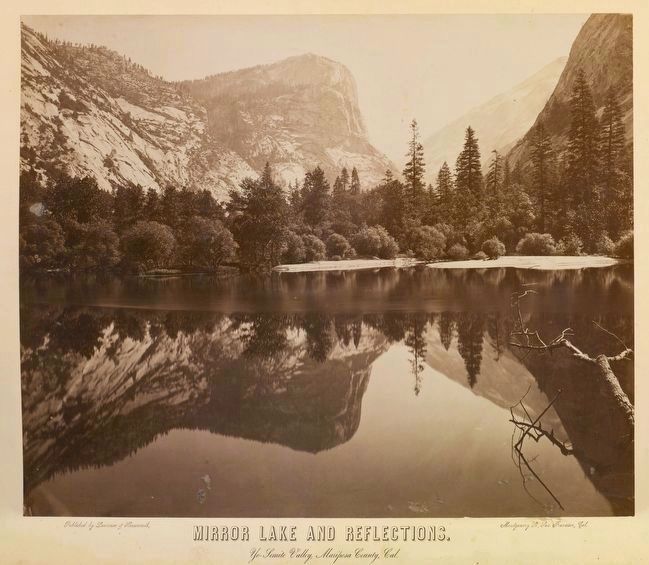
Crews dredge sand from Mirror Lake and spread it on Yosemite's icy roads in winter. Dredging, started in the 1880s, maintained the size of Mirror Lake's reflective surface. The Park discontinued this practice in 1971.
Erected by Yosemite Fund.
Topics. This historical marker is listed in these topic lists: Environment • Industry & Commerce. A significant historical year for this entry is 1971.
Location. 37° 44.832′ N, 119° 33.055′ W. Marker is in Yosemite National Park, California, in Mariposa County. This marker is on the Mirror Lake Trail. Touch for map. Marker is in this post office area: Yosemite National Park CA 95389, United States of America. Touch for directions.
Other nearby markers. At least 8 other markers are within 2 miles of this marker, measured as the crow flies. Natural Dam (within shouting distance of this marker); Bracken Fern and Baskets (about 400 feet away, measured in a direct line); Visitors at Mirror Lake (about 500 feet away); A Seasonal Lake (about 500 feet away); Selling the Sublime (about 700 feet away); Happy Isles Gaging Station (approx. 1.2 miles away); The Ahwahnee Porte Cochere (approx. 1.3 miles away); The Grand Lodge (approx. 1.3 miles away). Touch for a list and map of all markers in Yosemite National Park.
Credits. This page was last revised on June 16, 2016. It was originally submitted on March 26, 2015, by Eric Polk of Lakewood, California. This page has been viewed 394 times since then and 20 times this year. Photos: 1. submitted on March 26, 2015, by Eric Polk of Lakewood, California. 2. submitted on September 1, 2015. • Syd Whittle was the editor who published this page.
Editor’s want-list for this marker. Wide area view of the marker and its surroundings. • Photo of Mirror Lake today. • Photo of the Ice House foundation. • Can you help?

