New Madrid in New Madrid County, Missouri — The American Midwest (Upper Plains)
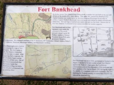
Fort Bankhead
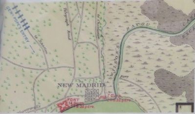
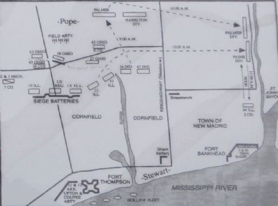
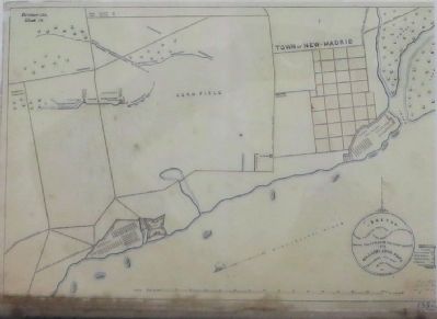
Fort Bankhead and its three regiments were under command of the newly arrived Colonel Lucius M. Walker, nephew of former President James Polk and a prominent Memphis businessman. His command consisted of the 5th Tennessee, 40th Tennessee, Colonel Alpheus Baker's 1st Alabama, Tennessee, Mississippi Infantry and Bankhead's Artillery.
Fort Bankhead tried to hold its own during the siege of New Madrid. Two heavy guns in the Fort became dismantled with two men wounded. After regaining their composure, the confederates began scoring some hits of their own. One of the Federal cannonballs that had landed inside Fort Bankhead, killing two mules, was reloaded and returned with devastating effect.
Fort Bankhead was never fully garrisoned or finished to the degree it needed to be and unable to hold New Madrid against the Federals' siege guns, the Confederate commanders ordered the evacuation of the gunboats and their position at the Fort in March 1862 during the night in the middle of a rainstorm with much confusion. The next morning the Federals quickly occupied New Madrid and entered the deserted fort.
Topics and series. This historical marker is listed in these topic lists: Forts and Castles • War, US Civil. In addition, it is included in the Former U.S. Presidents: #11 James K. Polk, and the Missouri’s Civil War series lists. A significant historical month for this entry is March 1862.
Location. 36° 35.024′ N, 89° 31.607′ W. Marker is in New Madrid, Missouri, in New Madrid County. Marker is at the intersection of Main Street and Levee Road, on the right when traveling south on Main Street. Located directly across from New Madrid Historical Museum. Touch for map. Marker is in this post office area: New Madrid MO 63869, United States of America. Touch for directions.
Other nearby markers. At least 8 other markers are within walking distance of this marker. Bissell's Submergible Saw (here, next to this marker); Battle of Island No. 10 (here, next to this marker); New Madrid (a few steps from this marker); New Madrid & Island No. Ten (within shouting distance of this marker); Water Route to Indian Territory (about 600 feet away, measured in a direct line); Higgerson School (about 600 feet away); They Passed This Way (about 600 feet away); A Growing State...A Shrinking County (approx. ¼ mile away). Touch for a list and map of all markers in New Madrid.
Also see . . . New Madrid Historical Museum. (Submitted on March 29, 2015.)
Credits. This page was last revised on June 16, 2016. It was originally submitted on March 28, 2015, by William Bruce of Madison, Wisconsin. This page has been viewed 629 times since then and 53 times this year. Photos: 1, 2, 3, 4, 5, 6, 7. submitted on March 28, 2015, by William Bruce of Madison, Wisconsin. • Bernard Fisher was the editor who published this page.
