Near Manassas in Prince William County, Virginia — The American South (Mid-Atlantic)
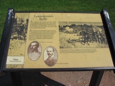
Confederates Rally
— First Battle of Manassas —
At that moment Generals Johnston and Beauregard arrived on the field to rally the scattered regiments, and the Confederate line began to re-form. Out of the woods behind you filed fresh reinforcements - Thomas J. Jackson's Virginia infantry. There at that line of cannon Jackson stood firm.
Topics. This historical marker is listed in this topic list: War, US Civil.
Location. This marker has been replaced by another marker nearby. 38° 48.997′ N, 77° 31.166′ W. Marker is near Manassas, Virginia, in Prince William County. Marker can be reached from the intersection of Sudley Road (U.S. 234) and Lee Highway (Route 29). The marker is one of the waysides along the Henry House Hill trail, which starts at the Manassas National Battlefield Park visitor center. Touch for map. Marker is in this post office area: Manassas VA 20109, United States of America. Touch for directions.
Other nearby markers. At least 8 other markers are within walking distance of this location. A different marker also named Confederates Rally (a few steps from this marker); War-Time Henry Hill (about 400 feet away, measured in a direct line); Various Sections of Virginia Artillery (about 600 feet away); Historic Farm Road Trace (about 600 feet away); Historic Road Trace (about 700 feet away); Robinson House (about 700 feet away); 7th Georgia Regiment (about 800 feet away); "…Like a Stone Wall" (about 800 feet away). Touch for a list and map of all markers in Manassas.
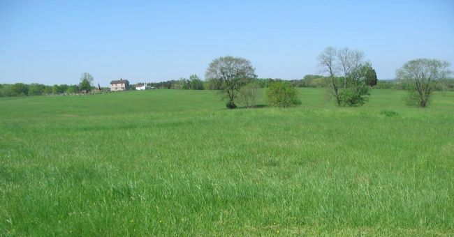
More about this marker. On the left are portraits of Generals Beauregard and Johnston. On the right is a depiction of the Confederate troops rallying with Johnston, The sight of Gen. Joe Johnston - wounded three times in previous wars - gave the battered soldiers new courage. Learning that the 4th Alabama had lost most of its field officers, Johnston personally lead those troops forward, keeping the regimental flag at his side. The Robinson house and farm are pictured in the background.
This marker was replaced by a new also one named Confederates Rally (see nearby markers).
Also see . . .
1. Manassas Battlefield. National Park Service site. (Submitted on June 8, 2008, by Craig Swain of Leesburg, Virginia.)
2. General Johnston's Report. Summarizing the performance of his command, Johnston wrote, "Every regiment and battery engaged performed its part well." (Submitted on June 8, 2008, by Craig Swain of Leesburg, Virginia.)
Credits. This page was last revised on February 21, 2017. It was originally submitted on June 7, 2008, by Craig Swain of Leesburg, Virginia. This page has been viewed 1,505 times since then and 28 times this year. Photos: 1, 2. submitted on June 7, 2008, by Craig Swain of Leesburg, Virginia. 3, 4. submitted on June 8, 2008, by Craig Swain of Leesburg, Virginia.


