Greenville in Greenville County, South Carolina — The American South (South Atlantic)
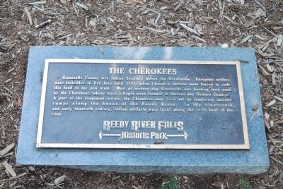
The Cherokees
— Reedy River Historic Park —
Greenville County was Indian Territory before the Revolution. European settlers were forbidden to live here until 1777, when Cherokee Indians were forced to cede this land to the new state. Most of modern day Greenville was hunting land used by the Cherokees, whose main villages were located in modern day Oconee County. A part of the Iroquoian nation, the Cherokee may have set up temporary summer camps along the banks of the Reedy River. In the nineteenth and early twentieth century, Indian artifacts were found along the north bank of the river.
Topics. This historical marker is listed in these topic lists: Colonial Era • Native Americans. A significant historical year for this entry is 1777.
Location. 34° 50.63′ N, 82° 24.038′ W. Marker is in Greenville, South Carolina, in Greenville County. Marker can be reached from Furman College Way. The marker is located on the walking path that runs parallel to Furman College Way, facing the main falls. Touch for map. Marker is in this post office area: Greenville SC 29601, United States of America. Touch for directions.
Other nearby markers. At least 10 other markers are within walking distance of this marker. Reedy River Falls (within shouting distance of this marker); Vardry Mill (within shouting distance of this marker); Old Mill Ruins (within shouting distance of this marker); Furman University (within shouting distance of this marker); Mill Village (within shouting distance of this marker); a different marker also named Furman University (within shouting distance of this marker); Liberty Bridge (within shouting distance of this marker); a different marker also named Furman University (within shouting distance of this marker); River Lodge (within shouting distance of this marker); Falls Reclaimed and the Liberty Bridge 2004 (about 300 feet away, measured in a direct line). Touch for a list and map of all markers in Greenville.
More about this marker. This marker is one of a series of markers in the Historic Falls Park covering bits of Greenville's history.
Also see . . .
1. Cherokee. The Cherokee are a Native American people historically settled in the Southeastern United States (principally Georgia, the Carolinas and Eastern Tennessee). (Submitted on April 29, 2010, by Brian Scott of Anderson, South Carolina.)
2. Cherokee Nation. Official website of the Cherokee Nation. (Submitted on April 29, 2010, by Brian Scott of Anderson, South Carolina.)
Credits. This page was last revised on June 16, 2016. It was originally submitted on June 7, 2008, by Brian Scott of Anderson, South Carolina. This page has been viewed 1,641 times since then and 58 times this year. Photos: 1. submitted on June 7, 2008, by Brian Scott of Anderson, South Carolina. 2. submitted on April 29, 2010, by Brian Scott of Anderson, South Carolina. • Kevin W. was the editor who published this page.

