Waimanalo in Honolulu County, Hawaii — Hawaiian Island Archipelago (Pacific Ocean)
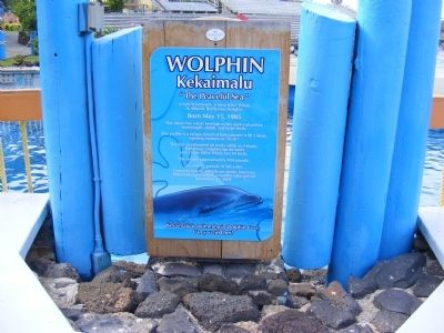
Wolphin Kekaimalu
"Peaceful Sea"
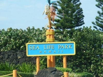
— Sea Life Park —
Born May 15, 1985.
She shows her whale heritage in her dark coloration, bodylength, width, and large teeth.
Her profile is unique blend of both parents with a short, tapering rostrum or "beak".
She has an estimated 66 teeth, while an Atlantic Bottlenose Dolphin has 88 teeth and a False Killer Whale has 44 teeth.
She weighs approximately 690 pounds.
She eats 45 pounds of fish a day.
Generally hybrid animals are sterile, however, Kekaimalu gave birth to a healthy baby girl on December 23, 2004.
Erected by Sea Life Park.
Topics. This historical marker is listed in this topic list: Animals. A significant historical month for this entry is May 1942.
Location. 21° 18.84′ N, 157° 39.762′ W. Marker is in Waimanalo, Hawaii, in Honolulu County. Touch for map. Marker is at or near this postal address: 41-202 Kalanianaole Highway (SR 72), Waimanalo HI 96795, United States of America. Touch for directions.
Other nearby markers. At least 8 other markers are within 11 miles of this marker, measured as the crow flies. Pali Road – From Trail to Highway (approx. 9.2 miles away); Nuuanu Pali Lookout (approx. 9.2 miles away); Battle of Nu’uanu – Uniting the Islands (approx. 9.2 miles away); Pali Road (approx. 9.2 miles away); Millennium Peace Garden (approx. 9.4 miles away); Amelia Earhart (approx. 10 miles away); Diamond Head Lighthouse (approx. 10.3 miles away); He Ho‘Omana‘o (approx. 10.4 miles away).
Credits. This page was last revised on June 16, 2016. It was originally submitted on April 4, 2015, by Don Morfe of Baltimore, Maryland. This page has been viewed 527 times since then and 27 times this year. Photos: 1, 2, 3, 4, 5, 6, 7. submitted on April 4, 2015, by Don Morfe of Baltimore, Maryland. • Andrew Ruppenstein was the editor who published this page.
