Lewiston in Niagara County, New York — The American Northeast (Mid-Atlantic)
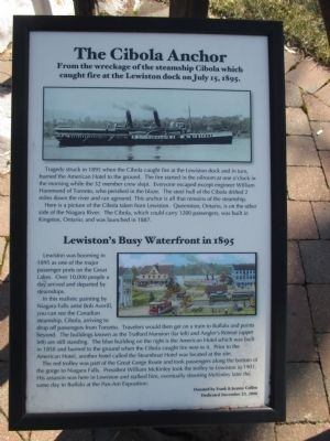
The Cibola Anchor
From the wreckage of the steamship Cibola which caught fire at the Lewiston dock on July 15, 1895.
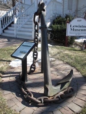
Tragedy struck in 1895 when the Cibola caught fire at the Lewiston dock and in turn, burned the American Hotel to the ground. The fire started in the oilroom at one o'clock in the morning while the 32 member crew slept. Everyone escaped except engineer William Hammond of Toronto, who perished in the blaze. The steel hull of the Cibola drifted 2 miles down the river and ran aground. This anchor is all that remains of the steamship.
Here is a picture of the Cibola taken from Lewiston. Queenston, Ontario, is on the other side of the Niagara River. The Cibola, which could carry 1200 passengers, was built in Kingston, Ontario, and was launched in 1887.
Lewiston's Busy Waterfront in 1895.
Lewiston was booming in 1895 as one of the major passenger ports on the Great Lakes. Over 10,000 people a day arrived and departed by steamships.
In this realistic painting by Niagara Falls artist Bob Averill, you can see the Canadian steamship, Cibola, arriving to drop off passengers from Toronto. Travelers would then get on a train to Buffalo and points beyond. The buildings known as the Trafford Mansion (far left) and Angler's Retreat (upper left) are still standing. The blue building on the right is the American Hotel which was built in 1858 and burned to the ground when the Cibola caught fire next to it. Prior to the American Hotel, another hotel called the Steamboat Hotel was located at the site.
The red trolley was part of the Great Gorge Route and took passengers along the bottom of the gorge to Niagara Falls. President William McKinley took the trolley to Lewiston in 1901. His assassin was here in Lewiston and stalked him, eventually shooting McKinley later the same day in Buffalo at the Pan-Am Exposition.
Erected 2008 by Frank & Joanne Collins.
Topics and series. This historical marker is listed in these topic lists: Disasters • Railroads & Streetcars • Waterways & Vessels. In addition, it is included in the Former U.S. Presidents: #25 William McKinley series list. A significant historical date for this entry is July 15, 1895.
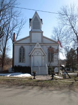
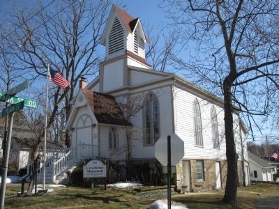
Location. 43° 10.317′ N, 79° 2.543′ W. Marker is in Lewiston, New York, in Niagara County. Marker is at the intersection of Plain Street and Niagara Street on Plain Street. Marker is at the front of the Lewiston Museum of Historical Association of Lewiston. The museum is housed in a church building. Touch for map. Marker is at or near this postal address: 469 Plain Street, Lewiston NY 14092, United States of America. Touch for directions.
Other nearby markers. At least 8 other markers are within walking distance of this marker. Little Yellow House - 1816 (about 300 feet away, measured in a direct line); Kiwanians Promoting Peace (about 400 feet away); Underground Railroad Station #6 (about 400 feet away); The First Religious Society of Lewiston (about 500 feet away); The Long and The Short House (about 500 feet away); 500 Center Street Archaeological Site (about 500 feet away); Hennepin Park (about 600 feet away); Kelsey Tavern (approx. 0.2 miles away). Touch for a list and map of all markers in Lewiston.
Related markers. Click here for a list of markers that are related to this marker. Markers for the Great Gorge Route and where President McKinley was shot as mentioned on the marker.
Credits. This page was last revised on July 7, 2021. It was originally submitted on April 5, 2015, by Anton Schwarzmueller of Wilson, New York. This page has been viewed 411 times since then and 20 times this year. Photos: 1, 2, 3, 4. submitted on April 5, 2015, by Anton Schwarzmueller of Wilson, New York.


