Bladensburg in Prince George's County, Maryland — The American Northeast (Mid-Atlantic)
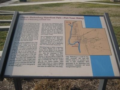
Historic Bladensburg Waterfront Park - Port Town History
The Ports of Bladensburg and Beall Town
Inscription.
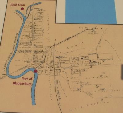
In 1742, the town of Bladensburg was created on the banks of the Anacostia River (also known as the Eastern Branch of the Potomac river) through an act of the Maryland General Assembly for the purpose of promoting trade and commerce. The act stated that the new port town was to be located on "the Eastern Branch of the Potomack River in Prince George's County near a place called Garrison Landing." The legislation was in response to a petition from the inhabitants of Beall Town to have a new town laid out. The new town was just downstream from the confluence of the Northwest and Northeast Branches, not far from where Beall Town was located.
Beall Town had been established in the 1720s and was officially recognized as a town by the Prince George's County Court in 1732. However, its viability as a port was extremely short lived. It fell victim to a problem that has plagued the area and its successor port town of Bladensburg up to the present day - namely, the filling in of the river channel with silt and fallen trees and trash. In 1738, just four years before petitioning for a new town, the residents of Beall Town complained that "freshets" [floodwaters] had "brought down trees and trash which...choak'd up the channel in the said branch so that boats and other craft cannot be brought up to lod or relod goods at the usual landing place."
The new port town of Bladensburg, named after Maryland Governor Thomas Bladen, thrived and became an important commercial center with wharves, taverns, and stores. Only five years after it was established, Bladensburg was named one of the tobacco inspection stations, and by 1761 it had grown so much that it was designated a "hundred" [similar to an election district] of Prince George's County.
Much of Bladensburg's growth and success can be attributed to the efforts and resourcefulness of one man - Christopher Lowndes. Lowndes was a merchant and a shipyard and ropewalk owner, as well as a commissioner of the town of Bladensburg from 1745 until his death 40 years later.
Bladensburg began to decline in importance as a tobacco shipping port in the 19th century with the silting in of the Anacostia River. The main railroad line to Washington, D.C., when first constructed in 1835, passed directly throught Bladensburg. However it was was soon altered to bypass the town, leaving Bladensburg serviced only by a spur or secondary line. This fact, coupled with the river siltation problem, sealed Bladensburg's demise as a tobacco shipping center; tobacco shipping ended in the port town before the middle of the 19th century.
Today, Bladensburgh is a small buy busy urban community, with large-scale industrial activity. It is currently in the midst of major revitalization efforts spearheaded by the Bladensburg Local Development Corporation and several government agencies.
Topics. This historical marker is listed in these topic lists: Colonial Era • Industry & Commerce • Settlements & Settlers • Waterways & Vessels. A significant historical year for this entry is 1742.
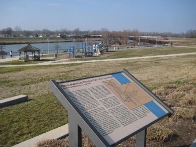
Location. 38° 56.136′ N, 76° 56.305′ W. Marker is in Bladensburg, Maryland, in Prince George's County. Marker can be reached from the intersection of Annapolis Road (Maryland Route 450) and 46th Street. Marker is in Bladensburg Waterfront Park, .2 miles south of the entrance at this intersection. Touch for map. Marker is in this post office area: Bladensburg MD 20710, United States of America. Touch for directions.
Other nearby markers. At least 8 other markers are within walking distance of this marker. The Battle of Bladensburg (1814) (within shouting distance of this marker); Duels and the Bladensburg Dueling Grounds (within shouting distance of this marker); The Incidental Cause of the Star-Spangled Banner (1814) (within shouting distance of this marker); First Unmanned Balloon Ascension (1784) (within shouting distance of this marker); Dinosaur Alley (within shouting distance of this marker); Encampment of Coxey's Army (1894) (within shouting distance of this marker); Colonial Ropemaking
(about 300 feet away, measured in a direct line); The First Telegraph Line (1844) (about 400 feet away). Touch for a list and map of all markers in Bladensburg.
Credits. This page was last revised on January 12, 2020. It was originally submitted on June 8, 2008, by F. Robby of Baltimore, Maryland. This page has been viewed 4,161 times since then and 67 times this year. Photos: 1. submitted on June 8, 2008, by F. Robby of Baltimore, Maryland. 2. submitted on July 18, 2010, by Craig Swain of Leesburg, Virginia. 3. submitted on June 8, 2008, by F. Robby of Baltimore, Maryland.


