Near Red Boiling Springs in Macon County, Tennessee — The American South (East South Central)
Gibbs Crossroads
Crossroads of War
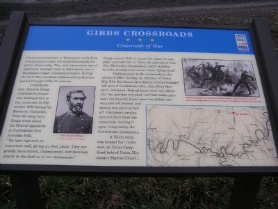
Confederate Gen. Braxton Bragg established a temporary headquarters at the crossroads in September 1862 during his Kentucky Campaign. From his camp here, Bragg wrote about his Federal opponents to Confederate Gen. Leonidas Polk, “We have captured an important mail, giving us their plans. They are greatly demoralized, disheartened, and deceived; utterly in the dark as to our movements.” Bragg ordered Polk to “press the matter of supplies” and told him to “seize the railroad at Cave City (Kentucky) immediately, and if possible by some arrangement secure some rolling stock.”
Fighting came to the crossroads in the spring of 1863. On May 11, 100 men of Union Major F. M. Davidson’s 14th Illinois Cavalry engaged 125 men of Confederate Gen. John Hunt Morgan’s command. Federal losses were one officer and two privates wounded, and four taken prisoner. Confederate losses were two killed, one wounded left behind, and several wounded carried off. Davidson’s cavalrymen fell back from the crossroads, leaving it open, temporarily, for Confederate movements.
A Union camp was located four miles west on Union Camp Road behind Union Missionary Baptist Church.
[Captions]:
Gen. Braxton Bragg Courtesy Library of Congress
Northern magazines depicted cavalry actions, many of which were dismounted engagements, as daring charges, as in Harper's Weekly, May 20, 1863.
Erected by Tennessee Civil War Trails.
Topics and series. This historical marker is listed in these topic lists: Settlements & Settlers • War, US Civil. In addition, it is included in the Tennessee Civil War Trails series list.
Location. 36° 26.992′ N, 85° 52.865′ W. Marker is near Red Boiling Springs, Tennessee, in Macon County. Marker is at the intersection of Carthage Road (State Highway 56) and Union Camp Road (State Highway 262), on the right when traveling south on Carthage Road. Touch for map. Marker is in this post office area: Red Boiling Springs TN 37150, United States of America. Touch for directions.
Other nearby markers. At least 8 other markers are within 6 miles of this marker, measured as the crow flies. Approximate Site of Civil War Skirmish (approx. one mile away); Joines Boarding House (approx. 5.9 miles away); 'Little Red Well' (approx. 5.9 miles away); The Thomas House Bed and Breakfast (approx. 5.9 miles away); Red Boiling Springs Hotel (approx. 5.9 miles away); Cloyd Bowling Alley (approx. 5.9 miles away); Armour's Hotel Bed and Breakfast (approx. 5.9 miles away); The Big Barren Buffalo Road (approx. 5.9 miles away). Touch for a list and map of all markers in Red Boiling Springs.
Additional commentary.
1. Witchers Crossroads - Gibbs Crossroads
Though known as Gibbs Crossroads today, this was named Witcher's Crossroads during the Civil War. It is even marked as "Witchers" on the Civil War era map.
— Submitted January 20, 2015.
Credits. This page was last revised on August 25, 2021. It was originally submitted on March 18, 2011, by Chad Comer of Gamaliel, Kentucky. This page has been viewed 1,023 times since then and 33 times this year. Last updated on April 7, 2015, by J. Makali Bruton of Accra, Ghana. Photo 1. submitted on March 18, 2011, by Chad Comer of Gamaliel, Kentucky. • Bill Pfingsten was the editor who published this page.
Editor’s want-list for this marker. Wide shot of marker and its surroundings. • Can you help?
