Near New Lawton in McNairy County, Tennessee — The American South (East South Central)
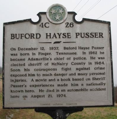
Buford Hayse Pusser
Erected by Tennessee Historical Commission. (Marker Number 4C 26.)
Topics and series. This historical marker is listed in these topic lists: Arts, Letters, Music • Entertainment • Law Enforcement • Roads & Vehicles. In addition, it is included in the Tennessee Historical Commission series list. A significant historical date for this entry is December 12, 1937.
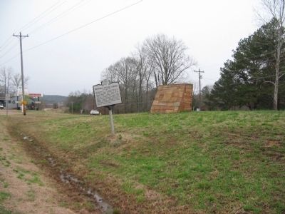
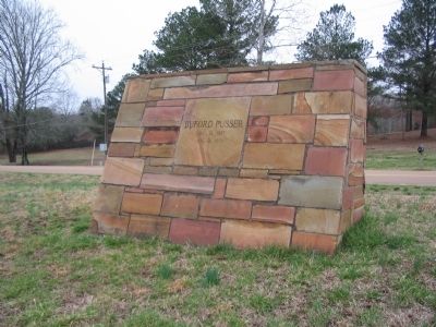
Location. 35° 12.357′ N, 88° 27.586′ W. Marker is near New Lawton, Tennessee, in McNairy County. Marker is at the intersection of U.S. 64 and Lawton Road, on the right when traveling west on U.S. 64. Touch for map. Marker is in this post office area: Selmer TN 38375, United States of America. Touch for directions.
Other nearby markers. At least 8 other markers are within 5 miles of this marker, measured as the crow flies. Approach to Shiloh (approx. 1.6 miles away); Purdy (approx. 2.3 miles away); October 4th 1969 (approx. 2.9 miles away); Memorial to Veterans (approx. 3.9 miles away); Adamsville In The Civil War (approx. 4.2 miles away); Fielding Hurst and Purdy (approx. 4.4 miles away); a different marker also named Approach to Shiloh (approx. 4.7 miles away); Buford Pusser Memorial Park (approx. 4.7 miles away).
Also see . . .
1. Buford Pusser Home & Museum. The museum collection includes the wrecked Corvette Pusser was driving at the accident which took his life. (Submitted on April 10, 2009, by Craig Swain of Leesburg, Virginia.)
2. Walking Tall. Information page about the original "Walking Tall" movie. (Submitted on April 10, 2009, by Craig Swain of Leesburg, Virginia.)
Additional commentary.
1. This Marker in a Movie
In last few seconds of the movie "Walking Tall - Final Chapter" (1977), there is a close-up shot of this marker. The camera shot looks west showing the last mile of road that Pusser was travelling on before he went off the road. In 1977 this was a two lane highway but it has since been changed to four lanes with a grass median. The movie is presently (January 2014) on Youtube.
— Submitted January 15, 2014, by David Graff of Halifax, Nova Scotia.
Credits. This page was last revised on January 24, 2020. It was originally submitted on April 10, 2009, by Craig Swain of Leesburg, Virginia. This page has been viewed 4,904 times since then and 113 times this year. Last updated on April 8, 2015, by J. Makali Bruton of Accra, Ghana. Photos: 1, 2, 3. submitted on April 10, 2009, by Craig Swain of Leesburg, Virginia. • Bill Pfingsten was the editor who published this page.


