Tellico Plains in Monroe County, Tennessee — The American South (East South Central)
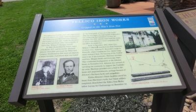
Tellico Iron Works
Gripped in the War's Iron Fist
In 1843, Elisha Johnson, former mayor of Rochester, N.Y., and his brother Ebenezer Johnson (died 1849) purchased the Tellico Iron Company. Established in 1824 amid rich deposits of brown hematite, it produced what was touted as “the finest grade of iron ore in the world.” After the war began, the high quality of Johnson’s iron influenced the Confederacy to seize his company. Col. H.B. Latrobe supervised the works to ensure that Johnson’s Union sympathies did not affect the production.
Early in December 1863, Union Gen. William T. Sherman marched into East Tennessee to relieve Gen. Ambrose E. Burnside’s troops in Knoxville, where Confederate James Longstreet besieged them. On learning of the Confederacy’s use of the ironworks, Sherman accompanied Gen. Morgan Smith and his troops there. They established headquarters at the Johnson house on December 9-11. Johnson was accused of operating the ironworks to support the Confederate army. Sherman presided over a trial in the house and acquitted Johnson, perhaps because of Johnson’s Northern birth and sympathies.
Elisha Johnson’s Union loyalties saved his house from Sherman’s torch, but Union soldiers completely demolished the Tellico Iron Works before leaving for Chattanooga on December 12.
(captions)
(lower left) Elisha Johnson Courtesy Monroe County Archives; Gen. William T. Sherman Courtesy Library of Congress
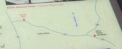
(upper right) Elisha Johnson house - Courtesy Sharon Cain
(lower right) Iron bars, Tellico Iron Works - Courtesy Charles Hall Museum
Erected by Tennessee Civil War Trails.
Topics and series. This historical marker is listed in these topic lists: Industry & Commerce • Settlements & Settlers • War, US Civil. In addition, it is included in the Tennessee Civil War Trails series list. A significant historical month for this entry is December 1863.
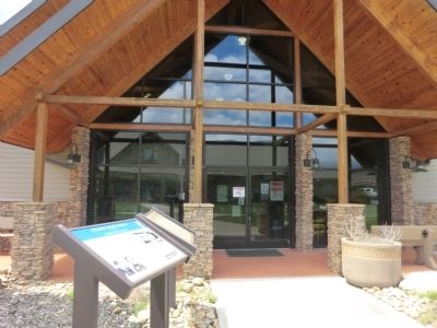
Location. 35° 22.007′ N, 84° 17.836′ W. Marker is in Tellico Plains, Tennessee, in Monroe County. Marker is at the intersection of Cherohola Skyway (Bypass Tennessee Route 165) and Herford Street, on the left when traveling west on Cherohola Skyway. The marker is located on the grounds of the Cherohala Skyway Visitor Center. Touch for map. Marker is at or near this postal address: 225 Cherohola Skyway, Tellico Plains TN 37385, United States of America. Touch for directions.
Other nearby markers. At least 8 other markers are within 8 miles of this marker, measured as the crow flies. Cherokee Heritage Trails (here, next to this marker); The Tennessee Overhill Experience (about 700 feet away, measured in a direct line); Fort Loudoun Massacre (about 700 feet away); Boyhood Home of Ray H. Jenkins (about 700 feet away); Scott Mansion (approx. 1.4 miles away); Early Gold Mining (approx. 7˝ miles away); Unicoi Turnpike Trail (approx. 7˝ miles away); Gold Mining at Coker Creek (approx. 7˝ miles away). Touch for a list and map of all markers in Tellico Plains.
Also see . . . Charles Hall Museum. (Submitted on July 16, 2014.)
Credits. This page was last revised on November 28, 2020. It was originally submitted on July 16, 2014, by Don Morfe of Baltimore, Maryland. This page has been viewed 1,118 times since then and 83 times this year. Last updated on April 9, 2015, by J. Makali Bruton of Accra, Ghana. Photos: 1, 2, 3. submitted on July 16, 2014, by Don Morfe of Baltimore, Maryland. • Bill Pfingsten was the editor who published this page.


