Caln Township near Coatesville in Chester County, Pennsylvania — The American Northeast (Mid-Atlantic)
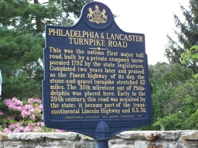
Philadelphia & Lancaster Turnpike Road
Erected 1999 by Pennsylvania Historical and Museum Commission.
Topics and series. This historical marker is listed in these topic lists: Industry & Commerce • Roads & Vehicles. In addition, it is included in the Lincoln Highway, and the Pennsylvania Historical and Museum Commission series lists. A significant historical year for this entry is 1792.
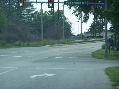
Location. 39° 59.306′ N, 75° 47.524′ W. Marker is near Coatesville, Pennsylvania, in Chester County. It is in Caln Township. Marker is at the intersection of Lincoln Highway East and Veterans Drive, on the right when traveling west on Lincoln Highway East. Touch for map. Marker is at or near this postal address: 1600 Lincoln Hwy E, Coatesville PA 19320, United States of America. Touch for directions.
Other nearby markers. At least 8 other markers are within 2 miles of this marker, measured as the crow flies. John G. Parke (about 300 feet away, measured in a direct line); Peter Bezellon (approx. 0.8 miles away); Whittier C. Atkinson (approx. 0.8 miles away); Brandywine Mansion (approx. 1.6 miles away); a different marker also named Brandywine Mansion (approx. 1.7 miles away); Graystone - Abram Francis Huston House (approx. 1.7 miles away); Charles Lukens Huston House Site (approx. 1.7 miles away); Brandywine Iron Works - Early 1800s (approx. 1.7 miles away). Touch for a list and map of all markers in Coatesville.
Also see . . . Philadelphia & Lancaster Turnpike Road. ExplorePAHistory.com (Submitted on July 14, 2011, by Mike Wintermantel of Pittsburgh, Pennsylvania.)
Credits. This page was last revised on February 7, 2023. It was originally submitted on June 9, 2008, by Bill Pfingsten of Bel Air, Maryland. This page has been viewed 2,601 times since then and 71 times this year. Photos: 1, 2. submitted on June 9, 2008, by Bill Pfingsten of Bel Air, Maryland.

