Byera, Charlotte, Saint Vincent and the Grenadines — Caribbean Region of the Americas (Lesser Antilles in the West Indies)
Byera Tunnel
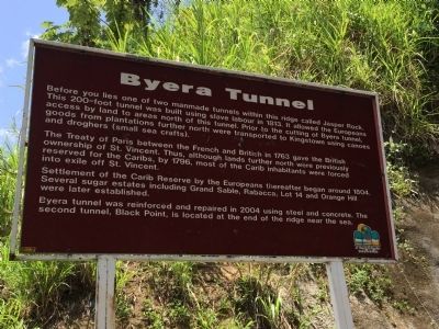
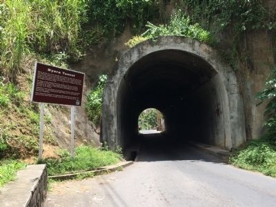
Before you lies one of two manmade tunnels within this ridge called Jasper Rock. This 200-foot tunnel was built using slave labour in 1813. It allowed the Europeans access by land to areas north of this tunnel. Prior to the cutting of Byera tunnel, goods from plantations further north were transported to Kingstown using canoes and droghers (small sea crafts).
The Treaty of Paris between the French and British in 1763 gave the British ownership of St. Vincent. Thus, although lands further north were previously reserved for the Caribs, by 1796, most of the Carib inhabitants were forced into exile off St. Vincent.
Settlement of the Carib Reserve by the Europeans thereafter began around 1804. Several sugar estates including Grand Sable, Rabacca, Lot 14 and Orange Hill were later established.
Byera tunnel was reinforced and repaired in 2004 using steel and concrete. The second tunnel, Black Point, is located at the end of the ridge near the sea.
Topics. This historical marker is listed in this topic list: Bridges & Viaducts. A significant historical year for this entry is 1813.
Location. 13° 15.565′ N, 61° 7.249′ W. Marker is in Byera, Charlotte. Touch for map. Touch for directions.
Other nearby markers. At least 6 other markers are within 18 kilometers of this marker, measured as the crow flies. Kingstown Old Public Library (approx. 16.2 kilometers away in Saint George); Saint Vincent World War I Monument (approx. 16.3 kilometers away in Saint George); Kingston Methodist Church (approx. 16.3 kilometers away in Saint George); Fort Charlotte (approx. 17 kilometers away in Saint Andrew); King Jugbo-Jugbo Fem (approx. 17.2 kilometers away in Saint Andrew); Welcome to Fort Charlotte (approx. 17.3 kilometers away in Saint Andrew).
Credits. This page was last revised on June 16, 2016. It was originally submitted on April 24, 2015, by J. Makali Bruton of Accra, Ghana. This page has been viewed 1,009 times since then and 50 times this year. Photos: 1, 2. submitted on April 24, 2015, by J. Makali Bruton of Accra, Ghana. • Andrew Ruppenstein was the editor who published this page.

