Orchard Knob in Chattanooga in Hamilton County, Tennessee — The American South (East South Central)
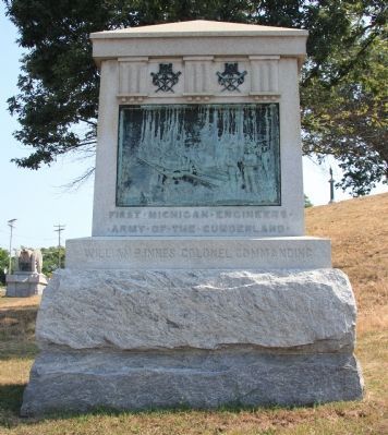
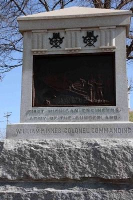
1st Michigan Engineers
Army of the Cumberland
— William P. Innes Colonel Commanding —
[Front Side]
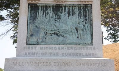
• Army • of • the • Cumberland •
William P. Innes Colonel Commanding
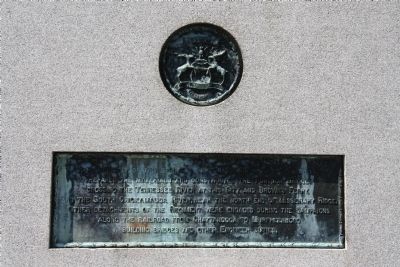
[Back Side]
Erected 1899 by the State of Michigan. (Marker Number MT-200.)
Topics and series. This historical marker is listed in this topic list: War, US Civil. In addition, it is included in the Chickamauga and Chattanooga National Military Park, Orchard Knob Reservation series list.
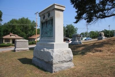
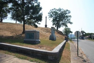
Location. 35° 2.336′ N, 85° 16.469′ W. Marker is in Chattanooga, Tennessee, in Hamilton County. It is in Orchard Knob. Marker is at the intersection of Ivy Street and Hawthorne Street, on the left when traveling east on Ivy Street. This historical marker is located in the middle of a residential neighborhood, in the city of Chattanooga, a little less than a mile west of Missionary Ridge. It is situated on the southern edge of the Orchard Knob Reservation, National Military Park and is positioned directly across the street from a residence located at 1802 Ivy Street. According to the location information provided by the National Park Service, “Monument is located on Orchard Knob Reservation, map site #32-29". Touch for map. Marker is in this post office area: Chattanooga TN 37404, United States of America. Touch for directions.
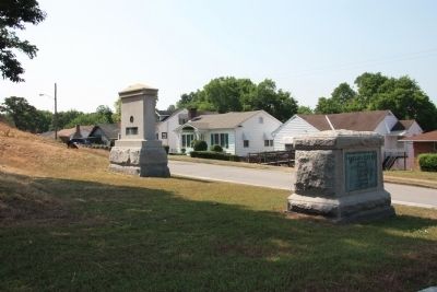
Other nearby markers. At least 8 other markers are within walking distance of this marker. The Monuments in the Western Section of Orchard Knob (here, next to this marker); 2nd & 33rd Massachusetts Infantry (a few steps from this marker); 5th & 20th Connecticut Infantry Regiment Monument (a few steps from this marker); Battery E, Pennsylvania Artillery (within shouting distance of this marker); Wisconsin State Monument (within shouting distance of this marker); 10th Michigan Infantry (within shouting distance of this marker); New Jersey State Monument (within shouting distance of this marker); 27th Pennsylvania Infantry (within shouting distance of this marker). Touch for a list and map of all markers in Chattanooga.
More about this marker. The 1st Michigan Engineers was engaged during the Chattanooga Campaign, but operated outside the limits of the National Park (from the plaque located near this monument).
According
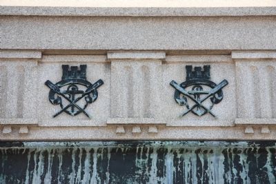
to the description information provided by the National Park Service, the monument is, “8' x 4' x 13' high, the smooth-faced granite monument has a temple-form shaft on a rock-faced double-block base. Shaft has bronze relief panel of a pontoon bridge, above which are 3 triglyphs and a pyramidal top.”
Regarding 1st Michigan Engineers. It should be noted that this monument displays a bronze bas-relief artwork, that depicts the combat action that this regiment saw from this position.
When discussing Battlefield Monuments, the National Park Service offers this special insight: "Of special interest are bronze bas-relief plaques attached to many monuments. These depict battle scenes based on veterans' eyewitness accounts. Because there are no photographs of the fighting, these plaques are among the best visual records of the battles."
Credits. This page was last revised on February 7, 2023. It was originally submitted on June 12, 2011, by Dale K. Benington of Toledo, Ohio. This page has been viewed 770 times since then and 20 times this year. Last updated on April 28, 2015, by Byron Hooks of Sandy Springs, Georgia. Photos: 1, 2, 3, 4, 5, 6, 7. submitted on June 12, 2011, by Dale K. Benington of Toledo, Ohio. 8. submitted on April 28, 2015, by Byron Hooks of Sandy Springs, Georgia. • Bill Pfingsten was the editor who published this page.
