Near Worden in Yellowstone County, Montana — The American West (Mountains)
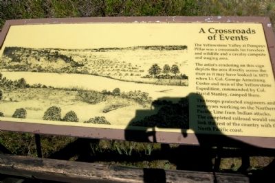
A Crossroads of Events
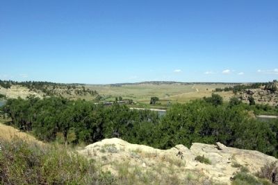
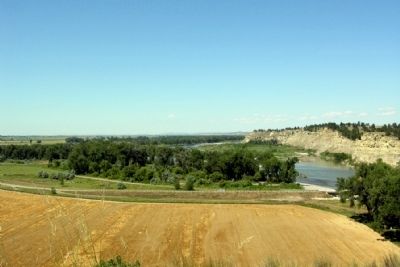
The artist’s rendering on this sign depicts the area directly across the river as it may have looked in 1873 when Lt. Col. George Armstrong Custer and men of the Yellowstone Expedition, commanded by Col. David Stanley, camped there.
The troops protected engineers and surveyors working on the Northern Pacific Line from Indian attacks. The completed railroad would soon link the rest of the country with the North Pacific coast.
Erected by Bureau of Land Management.
Topics. This historical marker is listed in these topic lists: Railroads & Streetcars • Wars, US Indian. A significant historical year for this entry is 1873.
Location. 45° 59.724′ N, 108° 0.333′ W. Marker is near Worden, Montana, in Yellowstone County. Marker can be reached from Old Highway 312, half a mile east of Bundy Road. Marker is located in Pompeys Pillar National Monument; the above directions are to the driveway entrance into the monument. Touch for map. Marker is in this post office area: Worden MT 59088, United States of America. Touch for directions.
Other nearby markers. At least 8 other markers are within walking distance of this marker. Pompey's Pillar (within shouting distance of this marker); The Changing Faces of Pompeys Pillar (about 400 feet away, measured in a direct line); The Pompeys Pillar Legacy (about 400 feet away); Three Forks: Clark's Party Splits (about 600 feet away); Yellowstone River: A Water Expressway (about 600 feet away); Transportation: Traveling Downstream (about 600 feet away); Transportation: Hoofing It (about 600 feet away); Injury Forces a Halt to Build Canoes (about 700 feet away). Touch for a list and map of all markers in Worden.
More about this marker. The marker may be accessed from the pathway and boardwalk that leads from the visitor center to the west side of Pompeys Pillar. The marker is at the end of the boardwalk, and it is approximately 1/4 mile from the visitor center to the marker.
Also see . . . Welcome to Friends of Pompeys Pillar. (Submitted on April 29, 2015.)
Credits. This page was last revised on May 5, 2020. It was originally submitted on April 29, 2015, by Duane Hall of Abilene, Texas. This page has been viewed 350 times since then and 8 times this year. Photos: 1, 2, 3, 4. submitted on April 29, 2015, by Duane Hall of Abilene, Texas.
Editor’s want-list for this marker. Photo of wide-view of marker and surrounding area. • Can you help?


