Paramus in Bergen County, New Jersey — The American Northeast (Mid-Atlantic)
Sluckup
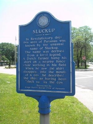
In Revolutionary days this area of Paramus was known by the unusual name of Sluckup. The name was derived from a local legend. A Dutch farmer hung his shirt on a nearby fence while working in his field. When he saw the shirt disappear into the mouth of a cow, he described the shirt as having been “sluck up” by the cow.
Ridge Ranch Social Club of Paramus
Erected by New Jersey, Bergen County Historical Society. (Marker Number 36.)
Topics and series. This historical marker is listed in this topic list: Colonial Era. In addition, it is included in the New Jersey, Bergen County Historical Society series list.
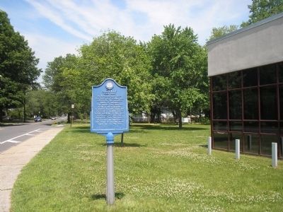
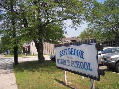
Location. 40° 55.836′ N, 74° 3.35′ W. Marker is in Paramus, New Jersey, in Bergen County. Marker is on Spring Valley Road, on the left when traveling south. Marker is located in front of the East Brook Middle School in Paramus, NJ. Touch for map. Marker is at or near this postal address: 190 Spring Valley Road, Paramus NJ 07652, United States of America. Touch for directions.
Other nearby markers. At least 8 other markers are within one mile of this marker, measured as the crow flies. Old Spring Valley Burial Ground (about 800 feet away, measured in a direct line); Washington Spring (approx. 0.4 miles away); a different marker also named Washington Spring (approx. 0.4 miles away); River Edge WWI Memorial (approx. 0.9 miles away); Maj. Ross E. Mulhare, U.S.A.F. (approx. 0.9 miles away); "The Soldier" (approx. 0.9 miles away); Wars Memorial (approx. 0.9 miles away); Maywood N.J. (approx. 1.1 miles away). Touch for a list and map of all markers in Paramus.
Also see . . . Bergen County Historical Society. Society website homepage (Submitted on June 13, 2008, by Bill Coughlin of Woodland Park, New Jersey.)
Credits. This page was last revised on December 15, 2021. It was originally submitted on June 13, 2008, by Bill Coughlin of Woodland Park, New Jersey. This page has been viewed 2,901 times since then and 71 times this year. It was the Marker of the Week June 15, 2008. Photos: 1, 2, 3. submitted on June 13, 2008, by Bill Coughlin of Woodland Park, New Jersey.


