Jonesborough in Washington County, Tennessee — The American South (East South Central)
Jacob Brown
1736-1785
Colonial and Revolutionary Service
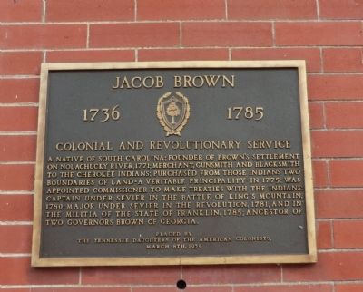
A native of South Carolina; Founder of Brown’s Settlement on Nolachucky River, 1771; Merchant, Gunsmith and Blacksmith to the Cherokee Indians; purchased from those Indians two boundaries of land-a Veritable Principality-in 1775; was appointed Commissioner to make treaties with the Indians; Captain under Sevier in the Battle of King’s Mountain, 1780; Major under Sevier in the Revolution, 1781, and in the militia of the State of Franklin, 1785; ancestor of two Governors Brown of Georgia.
Erected 1938 by Tennessee Daughters of the American Colonists.
Topics and series. This memorial is listed in these topic lists: Settlements & Settlers • War, US Revolutionary. In addition, it is included in the Daughters of the American Colonists series list. A significant historical year for this entry is 1771.
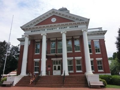
Location. 36° 17.652′ N, 82° 28.386′ W. Marker is in Jonesborough, Tennessee, in Washington County. Memorial is on East Main Street east of North Cherokee Street, on the right when traveling east. The marker is affixed to the wall of the Washington County Court House and is located to the left of the entrance doors. Touch for map. Marker is in this post office area: Jonesborough TN 37659, United States of America. Touch for directions.
Other nearby markers. At least 8 other markers are within walking distance of this marker. Jonesborough (here, next to this marker); Boone Trail Highway (a few steps from this marker); Chester Inn (about 300 feet away, measured in a direct line); Captain Christopher Taylor Home (about 400 feet away); Christopher Taylor House (about 400 feet away); May-Dishner House (about 500 feet away); First Abolition Publications (approx. 0.2 miles away); Jonesborough Veterans Park (approx. 0.2 miles away). Touch for a list and map of all markers in Jonesborough.
Credits. This page was last revised on March 27, 2017. It was originally submitted on October 23, 2013, by Don Morfe of Baltimore, Maryland. This page has been viewed 644 times since then and 32 times this year. Last updated on May 10, 2015, by J. Makali Bruton of Accra, Ghana. Photos: 1, 2. submitted on October 23, 2013, by Don Morfe of Baltimore, Maryland. • Bill Pfingsten was the editor who published this page.

