Near Dragoon in Cochise County, Arizona — The American Mountains (Southwest)
Confederate Graves at Dragoon Springs
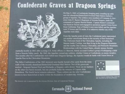
From the Apache point of view, the Confederate party represented yet another unwelcome threat to the security of their homeland. The Chokonen band of the Chiricahua Apache, including the famous leader Cochise, was then living in the Dragoon Mountains and nearby Dos Cabezas, Chiricahua, and Peloncillo Mountains. Relationships with the United States, already uneasy, became markedly hostile in 1861 after a young U.S. Army officer, Lt. Bascom, falsely accused Cochise's group of kidnapping a child from a Sonoita Valley ranch. By 1862, the Apaches viewed any soldiers, whether Union or Confederate, as enemy invaders. Two months after the Confederates were killed near Dragoon Springs, the Apaches would do battle with Union forces at Apache Pass in the Chiricahua Mountains.
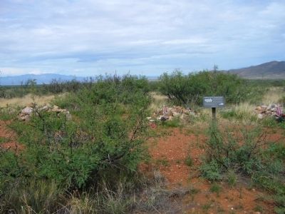
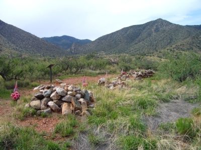
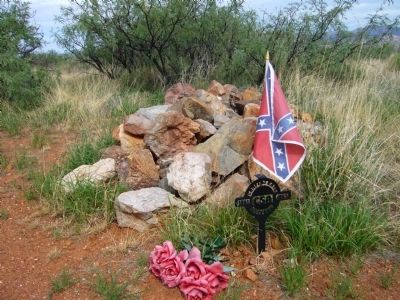
The fallen Confederates of the 1862 skirmish were hastily buried a few yards from the stone walls of the recently abandoned Butterfield Overland Mail Station. Two of the graves are marked – Sergeant Samuel Ford and Richardo, a Hispanic cattle drover. There are no markers on the other two burial mounds, but one probably holds the remains of Captain John Donaldson. The fourth burial remains unknown. These soldiers are the only Confederates known to have been killed in battle within the boundaries of modern-day Arizona.
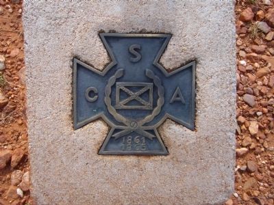
This historic site is maintained by the Arizona Division, Sons of Confederate Veterans.
Erected by Coronado National Forest.
Topics and series. This historical marker is listed in these topic lists: Cemeteries & Burial Sites • War, US Civil • Wars, US Indian. In addition, it is included in the Sons of Confederate Veterans/United Confederate Veterans series list. A significant historical date for this entry is May 5, 1862.
Location. 31° 59.877′ N, 110° 1.355′ W. Marker is near Dragoon, Arizona, in Cochise County. It is a short (200 yard) hike to reach the Dragoon Springs Stage Station and Confederate Grave site.
We have been notified that a recreational permit from the Arizona State Land Department is now required to use the Forest Road described in the directions that follow.
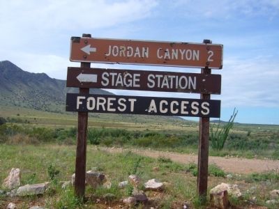
Directions to hike: Take exit 318 from Interstate 10 and travel southeast on Dragoon Road, to the town of Dragoon. As soon as you cross the railroad tracks turn right onto North Old Ranch Road (dirt road, ok for cars in dry weather). Follow N. Old Ranch Road 2.5 miles south to Forest Road 4232. Turn left (or east) and follow FR 4232 1.1 miles to the trailhead. The trail heads northeast for 200 yards to the stage station and grave site. Touch for map. Marker is in this post office area: Dragoon AZ 85609, United States of America. Touch for directions.
Other nearby markers. At least 6 other markers are within 14 miles of this marker, measured as the crow flies. Dragoon Springs Stage Stop (within shouting distance of this marker); Texas Canyon Pioneer Cemetery (approx. 4.3 miles away); Four miles southeast at Council Rocks (approx. 5.3 miles away); Chief Cochise (approx. 6.2 miles away); Mormon Battalion (approx. 13˝ miles away); Old Pearce Post Office (approx. 13˝ miles away).
Regarding Confederate Graves at Dragoon Springs. My "Project Proposal" has been accepted by National Forest Service Archeologist Bill Gillespie to replace the two erroneous interpretive markers at the station with three new interpretive markers. He has assigned to me the task of designing the markers.
The wording on this marker states that all four graves are "probably" all Confederate graves. The two outside
unmarked graves are those of Butterfield employees massacred on September 9, 1858. Only one grave is Confederate.
The Arizona Division of the Sons of Confederate Veterans will resist any and all efforts by any individual or agency to change the interpretive markers at this sacred site. There is no definitive proof that the graves are those of anyone but the FOUR CONFEDERATE SOLDIERS killed in action here on 5 May 1862. Two of the graves are marked--one for Sgt. Sam Ford and one for Richardo. The other two contain the remains of John Donaldson and an unknown CS soldier. There is ample documentation to support this. The Arizona Division SCV will resist any effort to change the markers or to remove any funerary items from this site. Removal of funerary items is a felony under Arizona Revised Statutes. We insist that the USFS not make any changes without consulting the officers of the Arizona Division. These graves are those of Confederate soldiers and, as the heirs of the United Confederate Veterans, we will defend them as strongly as our ancestors defended their Cause.
Additional commentary.
1. Access
Please update the directions and access description. I attempted to visit this marker today, February 16, 2024, and was stopped by a closed gate. Arizona State Land Department has blocked off the only vehicular access road and requires a recreational permit for entrance.
— Submitted February 16, 2024, by Sarah Horton of Sierra Vista, Arizona.
Photographed By Bill Kirchner, July 22, 2012
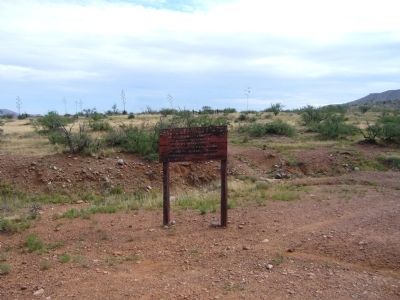
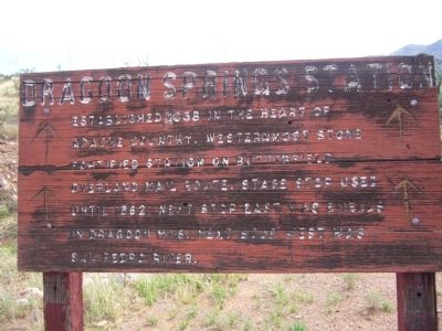
8. Sign at trailhead
Dragoon Springs Station
Established in 1858 in the heart of Apache Country. Westernmost stone fortified station on Butterfield Overland mail route. Stage Stop used until 1862. Next stop east was Ewells in Dragoon Mtns. Next stop west was San Pedro River.
Established in 1858 in the heart of Apache Country. Westernmost stone fortified station on Butterfield Overland mail route. Stage Stop used until 1862. Next stop east was Ewells in Dragoon Mtns. Next stop west was San Pedro River.
Credits. This page was last revised on February 21, 2024. It was originally submitted on July 24, 2012, by Bill Kirchner of Tucson, Arizona. This page has been viewed 2,743 times since then and 176 times this year. Last updated on May 11, 2015, by Curtis Tipton of Sierra Vista, Arizona. Photos: 1, 2, 3, 4, 5, 6, 7, 8, 9. submitted on July 24, 2012, by Bill Kirchner of Tucson, Arizona. • Bill Pfingsten was the editor who published this page.
