San Marcos Lempa, Usulután, El Salvador — Central America (West Coast)
San Marcos Lempa Bridge
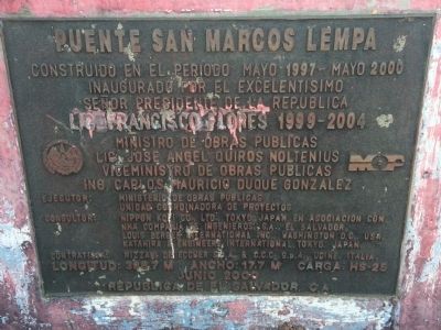
Puente San Marcos Lempa - Puente de Oro
Inaugurado por el excelentisimo Señor Presidente de la Republica
Lic. Francisco Flores 1999-2004
Ministro de Obras Publicas, Lic. Jose Angel Quiros Noltenius
Viceministro de Obras Publicas, Ing. Carlos Mauricio Duque Gonzalez
Ejecutor: Ministerio de Obras Publicas, Unidad Coordinadora de Proyectos
Consultor: Nippon Kobi Co., Ltd., Tokyo, Japan en asociacion con NHA Compañía de Ingenieros, S.A. El Salvador, Louis Berger International Inc., Washington D.C., USA, Katahira & Engineers International, Tokyo, Japan
Contratista: Rizzani de Eccher S.p.A. & C.C.C. S.p.A., Udine, Italia.
Longitud: 398.7 m Ancho: 17.7 m Carga HS-25
Junio 2000, Republica de El Salvador, C.A.
Constructed during May 1997 to May 2000
Inaugurated by the most excellent President of the Republic
Francisco Flores 1999-2004
[Government officials, consultants and contractors involved in the construction]
Length: 398.7 m Width: 17.7 m Load HS-025
June 2000, Republic of El Salvador, Central America
Erected 2000.
Topics. This historical marker is listed in this topic list: Bridges & Viaducts. A significant historical date for this entry is May 5, 1997.
Location. 13° 25.552′ N, 88° 42.081′ W. Marker is in San Marcos Lempa, Usulután. Touch for map. Touch for directions.
Other nearby markers. At least 1 other marker is within 26 kilometers of this marker, measured as the crow flies. The Cuscatlán Bridge (approx. 25.1 kilometers away in San Vicente).
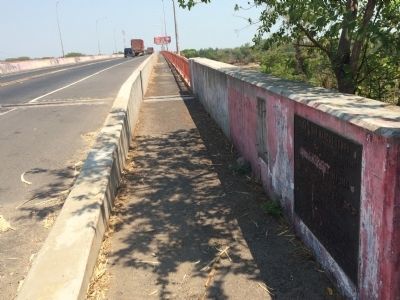
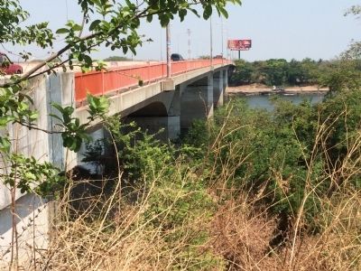
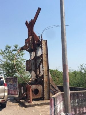
Regarding San Marcos Lempa Bridge. This bridge over the River Lempa is one of two bridges over the river that divides El Salvador into western and eastern halves. This bridge replaces an elegant bridge built in 1952, known as the Golden Bridge (Puente de Oro) for its similarity on a smaller scale with the Golden Gate Bridge. The previous bridge was destroyed by Farabundo Marti Liberation National forces in a coordinated attack on the bridge on October 15, 1981.
Also see . . . Photo of the destroyed Golden Bridge over the River Lempa, 1981. (Submitted on May 11, 2015, by J. Makali Bruton of Accra, Ghana.)
Credits. This page was last revised on September 13, 2018. It was originally submitted on May 11, 2015, by J. Makali Bruton of Accra, Ghana. This page has been viewed 833 times since then and 38 times this year. Photos: 1, 2, 3, 4. submitted on May 11, 2015, by J. Makali Bruton of Accra, Ghana. • Andrew Ruppenstein was the editor who published this page.


