Missouri River Flood
June 2011 - September 2011
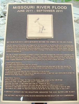
— Matthew Placzek's Labor Monument Became the Symbol of the 2011 Flood. —
The 2011 Missouri River Flood was triggered by record snowfall in the Rocky Mountains of Montana and Wyoming and near record spring rainfall in the upper Missouri River Basin. High water levels threatened communities of all sizes along the river from Montana to northwestern Missouri, including Omaha. The flood forced the closing of several Missouri River traffic crossings in the flooded corridor and closed or damaged portions of Interstate 29.
The City of Omaha implemented a Unified Command Team that managed the community's response to the flood from May 30, 2011 to September 7, 2011. Team members included representatives from the Omaha Public Works Department, Omaha Fire Department, Omaha Police Department, Omaha Parks, Recreation & Public Property Department, the Omaha Airport Authority and the Office of Mayor Jim Suttle.
Flood Fighting Statistics
• Volunteers filled approximately 850,000 sandbags.
• The capacity to remove storm water from the immediate downtown area back to the river required the installation of 90 temporary supplemental pumps to help alleviate flooding on the dry-side of 13 miles of levees protecting Omaha.
• 70 wells and 35 pumps kept the airport operational during the flood.
• A temporary levee over 2,000 feet long, 42 feet wide, and over 10 feet high, was constructed
Flood Water Statistics
• Normal navigable river stage: 16.7 feet on the Omaha Gage located at the I-480 Bridge.
• Minor flood stage: 29 feet; lasted from June 1 - September 9, 2011.
• Moderate flood level: 32 feet lasted from June 12 - August 29, 2011.
• Maximum water flow past Omaha in cfs (cubic feet per second): 271,000 on July 2, 2011.
• The Flood of 1952 lasted 25 days and crested at 40.20 feet on the Omaha Gage on April 18, 1952.
• The Flood of 2011 lasted 101 days and crested at 36.29 feet on the Omaha Gage on July 2, 2011.
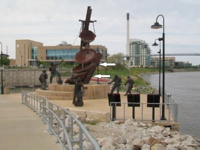
A bronze marker on the sculpture indicates the High Water Line in 2011.
The Historic 1952 Flood Level is also indicated on the sculpture as a comparison.
AP Photo/Nati Harnik
Topics. This historical marker is listed in these topic lists: Disasters • Waterways & Vessels. A significant historical month for this entry is April 1937.
Location. 41° 15.793′ N, 95° 55.414′ W. Marker is in Omaha, Nebraska, in Douglas County. It is in Downtown. Marker is on Riverfront Drive, on the right when traveling north. Marker and monument are at Lewis and Clark Landing, along the Missouri River between the I-480 and Bob Kerrey Pedestrian Bridges. Touch for map. Marker is at or near this postal address: 601 Riverfront Drive, Omaha NE 68102, United States of America. Touch for directions.
Other nearby markers.
Related marker. Click here for another marker that is related to this marker.
Also see . . .
1. Missouri River Flood Videos on Yahoo. (Submitted on May 15, 2015, by William Fischer, Jr. of Scranton, Pennsylvania.)
2. Great Missouri River Flood of 2011. (Submitted on May 16, 2015, by William Fischer, Jr. of Scranton, Pennsylvania.)
Credits. This page was last revised on February 16, 2023. It was originally submitted on May 15, 2015, by William Fischer, Jr. of Scranton, Pennsylvania. This page has been viewed 630 times since then and 35 times this year. Photos: 1, 2. submitted on May 15, 2015, by William Fischer, Jr. of Scranton, Pennsylvania.

