Hudson Bay in Vancouver in Clark County, Washington — The American West (Northwest)
The Reservation Monument
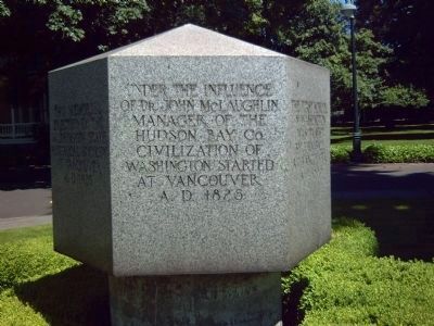
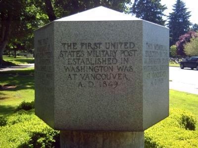
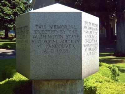
Under the influence of Dr. John McLaughlin, Manager of the Hudson Bay Co., civilization of Washington started at Vancouver, A.D. 1825.
[Side two of six]:
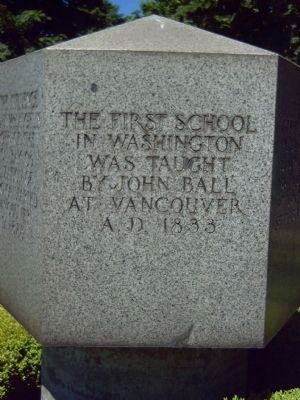
The first school in Washington was taught by John Ball, at Vancouver, A.D. 1833.
[Side three of six]:
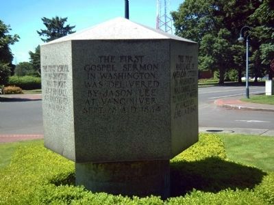
The first gospel sermon in Washington was delivered by Jason Lee at Vancouver, Sept. 28, A.D. 1834.
[Side four of six]:
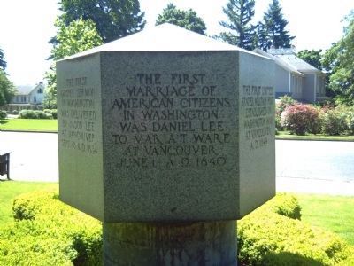
The first marriage of American Citizens in Washington was Daniel Lee to Maria T. Ware at Vancouver, June 11, A.D. 1840.
[Side five of six]:
The first United States military post established in Washington was at Vancouver, A.D. 1849.
[Side six of six]:
This memorial erected by the Washington State Historical Society at Vancouver, A.D. 1925.
Erected 1925 by Washington State Historical Society.
Topics. This historical marker and monument is listed in these topic lists: Exploration • Notable Places • Settlements & Settlers. A significant historical date for this entry is June 11, 1916.
Location. 45° 37.728′ N, 122° 39.856′ W. Marker is in Vancouver, Washington, in Clark County. It is in Hudson Bay. Marker is at the intersection of E. Evergreen Way and Officers Row on E. Evergreen Way. West of the Evergreen Blvd Circle. Touch for map. Marker is in this post office area: Vancouver WA 98661, United States of America. Touch for directions.
Other nearby markers. At least 8 other markers are within walking distance of this marker. Congressional Medal of Honor Monument (within shouting distance of this marker); Cannon Replica Project (within shouting distance of this marker); Officers Row (about 400 feet away, measured in a direct line); The O. O. Howard House (about 400 feet away); The Infantry Barracks (about 700 feet away); Clark County Veterans Memorial (about 700 feet away); The Post Hospital (approx. 0.2 miles away); The Artillery Barracks (approx. 0.2 miles away). Touch for a list and map of all markers in Vancouver.
Regarding The Reservation Monument. The Reservation Monument was unveiled as part of the Vancouver Centennial, a major event observed through the spring and summer of 1925. The granite marker was dedicated on May 1 by the Washington State Historical Society. Without noting the long-term occupation of native people along the lower Columbia, the marker commemorated the first “permanent” settlement in what became Washington State. The marker was placed at “Century Point,” on the North Bank highway, just east of the barracks. It was later moved to the front of the U.S. Grant House.
(Source: Ted Van Arsdol, “Vancouver’s Centennial Year” Clark County History 26 (1975), 14-16)
At a later date, it was moved once again to its current location, about one third of a mile west of the U.S. Grant House.
Additional commentary.
1. Outpost of Western Civilization
Vancouver, Washington is the oldest white settlement in the West, located where the Hudson Bay Company established Fort Vancouver. Development of Fort Vancouver by the Hudson’s Bay Company from 1825 through 1846 was a seminal event in the history of the Pacific Northwest and lower Columbia River basin. The fort was an outpost of Western civilization during that period and functioned as a commerce and provisionary center for the lucrative fur trade throughout the Pacific Northwest. It was named in honor of the famous British sea explorer, Captain George Vancouver.
— Submitted June 19, 2008, by Kevin W. of Stafford, Virginia.
Credits. This page was last revised on February 7, 2023. It was originally submitted on June 18, 2008, by Kevin W. of Stafford, Virginia. This page has been viewed 1,382 times since then and 13 times this year. Photos: 1, 2, 3, 4, 5, 6, 7. submitted on June 18, 2008, by Kevin W. of Stafford, Virginia.
