Coteau-du-Lac in Vaudreuil-Soulanges, Québec — Central Canada (French-Canadian)
Changes in the landscape
Un paysage modifie
Inscription.
English:
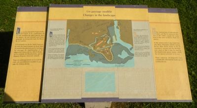
The construction of hydroelectric dams and the St. Lawrence Seaway in the 1950s caused the water level of the river to fall by about 2.5 metres.
At the eastern end of Lake Saint-François, dams, sluicegates and the Coteau-du-Lac dikes divert much of the St. Lawrence’s current into the Beauharnois canal so that it may be used by the Beauharnois power station, which has no natural reservoir of its own.
These waterway developments have considerably affected the landscape of Coteau-du-Lac.
The former shoreline at Coteau-du-Lac
Before the hydroelectric dams and the St. Lawrence Seaway (were) built, the point of Coteau-du-Lac jutted into the river. At that time, water flowed through the “rigolet,” filled the canal and washed into the earthworks ditches.
Were it not for the development which changed the river’s level, you would now be standing with both feet in water!
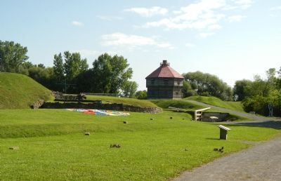
Look for a row (of) concrete blocks placed along the ground. They indicate the line where the water previously met the shore.
French:
La construction de barrages hydroélectrique et la canalisation de la voie maritime du Saint-Laurent, dans les années 50, ont entrainé une baisse générale du niveau des eaux de fleuve de 2,5 mètres.
A l’extrémité est du lac Saint-François, le cours du Saint-Laurent est dévié dans la canal de Beauharnois par les barrages, les ouvrages de régularisation et les digues de Coteau-du-lac afin d’alimenter la centrale de Beauharnois, qui ne dispose d’aucun réservoir naturel.
Tous ces aménagements sur la voie fluviale ont sensiblement modifié les paysages du Coteau-du-lac.
Les anciennes berges à Coteau-du-lac
Avant la construction des barrages hydro-électrique et la canalisation de la voie maritime du Saint-Laurent, les eaux du fleuve contournaient la point de Coteau-du-lac. Elles inondaient ainsi le canal rigolet, pénétraient à l’intérieur du canal et baignaient les fossés de ouvrages de terre.
N’eut été des aménagement qui ont modifié le niveau de eaux de fleuve, vous auriez présentement les deux pieds dan l’eau!
Observez la ligne sur le terrain formée par les blocs de béton, elle indique l’ancienne limite que les eaux atteignaient sur le site.
Erected by Parks Canada / Parcs Canada.
Topics. This historical marker is listed in this topic list: Waterways & Vessels.
Location. 45° 17.215′ N, 74° 10.599′ W. Marker is in Coteau-du-Lac, Québec, in Vaudreuil-Soulanges. Marker can be reached from Chemin du Fleuve close to Rue
du Fort, on the left. Touch for map. Marker is at or near this postal address: 307, Coteau-du-Lac QC J0P 1B0, Canada. Touch for directions.
Other nearby markers. At least 8 other markers are within walking distance of this marker. The Coteau-du-Lac rapids (within shouting distance of this marker); Why a canal at Coteau-du-Lac? (within shouting distance of this marker); The first lock canal in North America (within shouting distance of this marker); The “rigolet” canal (within shouting distance of this marker); The First Inhabitants (within shouting distance of this marker); The construction of the canal (within shouting distance of this marker); A supply centre / Un poste de ravitaillement (within shouting distance of this marker); A canal excavated in the rock (within shouting distance of this marker). Touch for a list and map of all markers in Coteau-du-Lac.
More about this marker. This marker is located at Coteau-du-Lac National Historic Site.
Credits. This page was last revised on June 16, 2016. It was originally submitted on May 29, 2015, by Barry Swackhamer of Brentwood, California. This page has been viewed 249 times since then and 7 times this year. Photos: 1, 2. submitted on May 29, 2015, by Barry Swackhamer of Brentwood, California. • Andrew Ruppenstein was the editor who published this page.

