Hales Corners in Milwaukee County, Wisconsin — The American Midwest (Great Lakes)
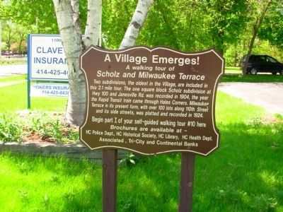
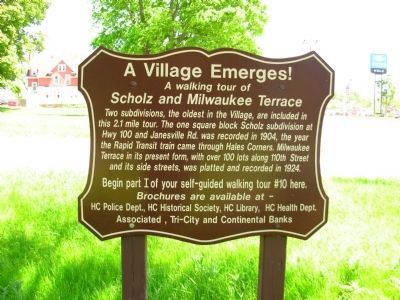
A Village Emerges!
A walking tour of
— Scholz and Milwaukee Terrace —
Inscription.
Two subdivisions, the oldest in the Village, are included in this 2.1 mile tour. The one square block Scholz subdivision at Hwy 100 and Janesville Rd. was recorded in 1904, the year the Rapid Transit train came through Hales Corners. Milwaukee Terrace in its present form, with over 100 lots along 110th Street and its side streets, was platted and recorded in 1924.
Begin part I of your self-guided walking tour #10 here. Brochures are available at - HC Police Dept., HC Historical Society, HC Library, HC Health Dept. Associated, Tri-City, and Continental Banks
Erected by Hales Corners Historical Society.
Topics. This historical marker is listed in this topic list: Settlements & Settlers. A significant historical year for this entry is 1904.
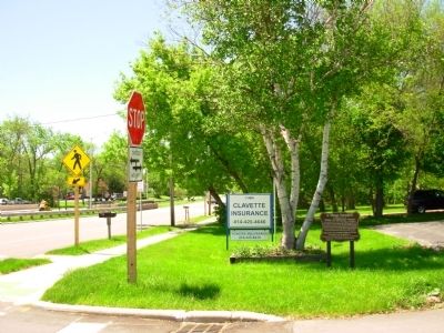
Location. 42° 56.252′ N, 88° 3.041′ W. Marker is in Hales Corners, Wisconsin, in Milwaukee County. Marker is at the intersection of West Janesville Road and South 110th Street on West Janesville Road. Touch for map. Marker is at or near this postal address: 11000 West Janesville Road, Hales Corners WI 53130, United States of America. Touch for directions.
Other nearby markers. At least 8 other markers are within 2 miles of this marker, measured as the crow flies. Hales Corners – A Crossroads Community (approx. 0.2 miles away); The German Evangelical Church / Brach’s Animal Hospital (approx. 0.2 miles away); Hales Corners – A Farm Village (approx. ¼ mile away); Early 1900s Business District (approx. 0.3 miles away); Black Botanical Heritage: (approx. 0.9 miles away); John Voight - Boerner Botanical Gardens Director, 1941-1979 (approx. one mile away); St. Mary’s Church and Cemetery (approx. 1.2 miles away); Wisconsin's Lime Industry (approx. 1.4 miles away). Touch for a list and map of all markers in Hales Corners.
Credits. This page was last revised on June 16, 2016. It was originally submitted on June 1, 2015, by Paul Fehrenbach of Germantown, Wisconsin. This page has been viewed 367 times since then and 15 times this year. Photos: 1, 2, 3. submitted on June 1, 2015, by Paul Fehrenbach of Germantown, Wisconsin. • Andrew Ruppenstein was the editor who published this page.


