Hudson Bay in Vancouver in Clark County, Washington — The American West (Northwest)
From Military to Municipal Airfield
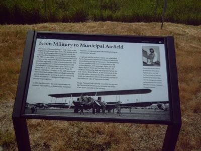
In 1925, the Vancouver Barracks Aerodrome was renamed Pearson Field, in honor of Lt. Alexander Pearson, a young army pilot killed while piloting an experimental aircraft.
A separate field for civilian aviation was established by the Vancouver Chamber of Commerce, later to be controlled by the City of Vancouver. The dominating military presence was soon overshadowed by the civilian presence, with passenger flights, air-mail flights, flight schools, and local air services. All civilian activity at the field was suspended when the U.S. entered World War II. At the conclusion of the war, the military declared the field surplus to their needs and transferred title to the military portion of the field to the City of Vancouver in 1949.
Today Pearson Field is jointly owned by the city and the National Park Service, and remains one of the oldest active air fields in the country.
Erected by Vancouver National Historic Reserve.
Topics. This historical marker is listed in these topic lists: Air & Space • Military. A significant historical year for this entry is 1905.
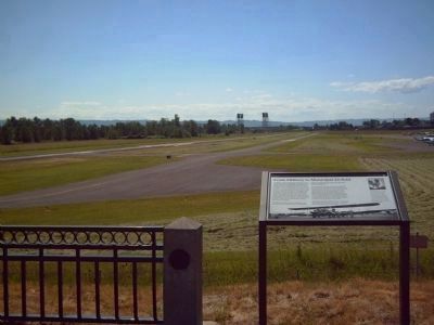
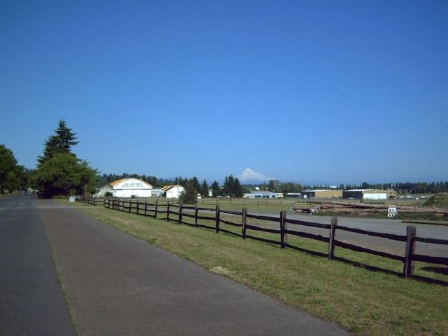
Location. 45° 37.227′ N, 122° 38.984′ W. Marker is in Vancouver, Washington, in Clark County. It is in Hudson Bay. Marker is on S. V Street near Columbia House Boulevard. Touch for map. Marker is in this post office area: Vancouver WA 98661, United States of America. Touch for directions.
Other nearby markers. At least 8 other markers are within walking distance of this marker. U. S. Grant Memorial (approx. 0.3 miles away); Ilchee (approx. 0.4 miles away); Pearson Airfield (approx. 0.4 miles away); Early Aviation History in Vancouver (approx. 0.4 miles away); Carlton Foster Bond (approx. 0.4 miles away); The Chkalov Transpolar Flight (approx. 0.4 miles away); The Soviet Transpolar Flight of 1937 (approx. 0.4 miles away); The 321st Observation Squadron (1923-1941) (approx. 0.4 miles away). Touch for a list and map of all markers in Vancouver.
More about this marker. The background photograph on the marker has the caption, "This Curtiss B-2 Condor was one of twelve fabric-covered bombers built between 1929 and 1930. The plane (picture here, ca. 1930) was brought to Pearson from San Diego to train bomber pilots, but advances in aviation technology rendered this plane obsolete by 1934. Photograph by Dale Denny, Courtesy of Pearson Air Museum.

Photographed By Kevin W., June 12, 2008
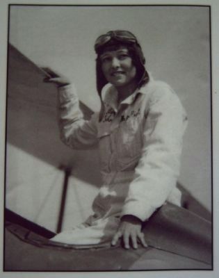
3. Upper right photograph on the "From Military to Municipal Airfield" Marker
Pearson Field was also a training ground for some of the nation's top femaile pilots. Ann "Half Pint" Bohrer (above in 1929) paid for lessons at Tex Rankin's flying school by working as his secretary and by performing in his acrobatic flying demonstrations. Courtesy of Pearson Air Museum.
Credits. This page was last revised on February 7, 2023. It was originally submitted on June 19, 2008, by Kevin W. of Stafford, Virginia. This page has been viewed 1,476 times since then and 10 times this year. Photos: 1, 2, 3, 4. submitted on June 19, 2008, by Kevin W. of Stafford, Virginia.


