Captain in Craig County, Virginia — The American South (Mid-Atlantic)
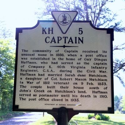
Captain
Erected 1998 by Department of Historic Resources. (Marker Number KH-5.)
Topics and series. This historical marker is listed in this topic list: Political Subdivisions. In addition, it is included in the Postal Mail and Philately, and the Virginia Department of Historic Resources (DHR) series lists. A significant historical date for this entry is February 9, 1853.
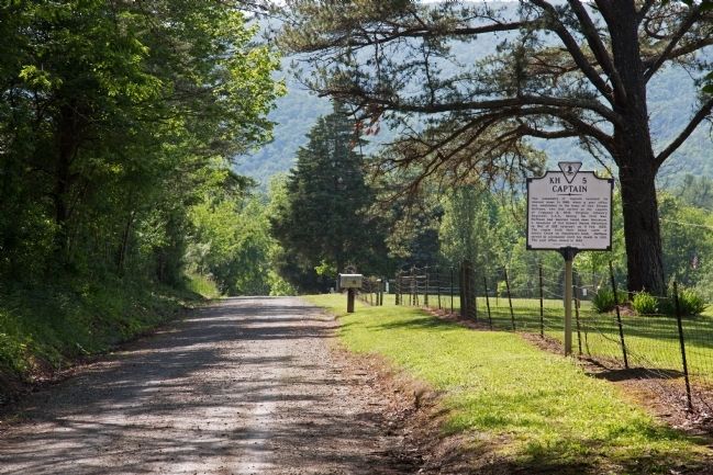
Location. 37° 23.551′ N, 80° 27.336′ W. Marker is in Captain, Virginia, in Craig County. Marker is at the intersection of Johns Creek Road (County Route 632) and Route 601 when traveling west on Johns Creek Road. Most GPS navigators will take you to Captain. From US 460 take Route 42 to 601 and climb over the mountain on the gravel road to Captain. Route 632 is the paved route from Captain to New Castle via Route 311. Touch for map. Marker is in this post office area: New Castle VA 24127, United States of America. Touch for directions.
Other nearby markers. At least 8 other markers are within 12 miles of this marker, measured as the crow flies. Craig County / Giles County (approx. 4½ miles away); Giles County / Montgomery County (approx. 7½ miles away); Virginia Polytechnic Institute and State University (approx. 7.8 miles away); Camp John J. Pershing (approx. 10.9 miles away); Eggleston's Springs (approx. 11.1 miles away); Snidow Pioneers (approx. 11.2 miles away); Westview Cemetery (approx. 11.3 miles away); Frederick Dewey Durham (approx. 11.3 miles away).
Credits. This page was last revised on June 16, 2016. It was originally submitted on June 5, 2015, by J. J. Prats of Powell, Ohio. This page has been viewed 804 times since then and 31 times this year. It was the Marker of the Week July 12, 2015. Photos: 1, 2. submitted on June 5, 2015, by J. J. Prats of Powell, Ohio.

