Parishville in St. Lawrence County, New York — The American Northeast (Mid-Atlantic)
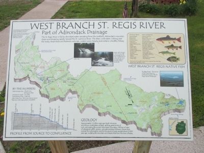
West Branch St. Regis River
Part of Adirondack Drainage
West Branch St. Regis Native Fish.
Common name - Genus and Species
Brown Bullhead - Ictalurus nebulosus
Brown Trout - Salmo trutta
Brook Trout - Salvelinus fontinalis
Common Shiner - Lixulis cornutus
Creek Chub - Semotilus atromaculatis
Cutlip Minnow - Exoglossum maxillingua
Eastern Blacknose Dace - Rhinichthys atratulus
Fallfish - Semotilus corporalis
Fantail Darter - Etheostoma flabellare
Golden Shiner - Notemigonus crysoleucas
Longnose Dace - Rhinichthys cataractae
Northern Redbelly Dace - Phoxinus eos
Pumpkinseed - Lepomis gibbosus
Rock Bass - Ambloplites rupestris
Smallmouth Bass - Micropterus dolomieui
Walleye - Sander itreus
White Sucker - Catostomus commersoni
Yellow Perch - Perca flavescens
Most commonly caught: Creek Chub, Longnose Dace, Rock Bass, Brook Trout, and Brown Trout.
St. Regis Pond - The Source of the West Branch is protected as part of the St. Regis Canoe Wilderness.
Sylvan Falls (Private) - One of many falls and cascades on the river, located about 7 miles upstream and 215 feet higher in elevation above Parishville.
Allen Falls
The West Branch enters the Middle Branch to form the Greater St. Regis River at elevation 300 feet above sea level.
The river meanders 23.5 miles down to its confluence with the St. Lawrence River in Canada, 3 miles north of Hogansburg, at elevation 155 feet above sea level.
By the Numbers.
Total drainage agrea - 173,415 Acres (271 Square Miles)
West Branch Length - 70.5 miles
Total elevation drop - 1,285 feet
Mean Water Flow - 340 Cubic Feet per Second
Data from USCG Gaging Station 04268800.
Profile from Source to Confluence.
St. Regis Pond, 1,620'
Augerhole Falls, 1,520'
High Falls, 1,460'
Sylvan Falls, 1,100'
Jones Road, 970'
Parishville Flow, 885'
Allen Falls Reservoir, 742'
Allen Falls, 640'
West Stockholm, 390'
Winthrop, 300'
Geology
Approximately 1.2 billion years ago North American and African crustal plates collided, uplifting great domes of rock, and creating the ancient Adirondack Mountains. Millions of years of subsequent uplifts, erosion, and sedimentation followed. Glaciers that covered the metamorphic rock for thousands of years receded about 12,000 years ago, scuplting the mountains and streams that form the rivers of today.
Topics. This historical marker is
listed in this topic list: Natural Features.
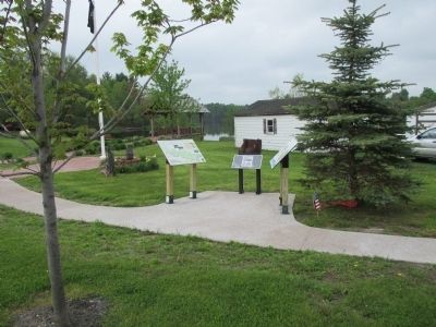
Location. 44° 37.696′ N, 74° 48.835′ W. Marker is in Parishville, New York, in St. Lawrence County. Marker is at the intersection of Main Street (New York State Route 72) and Catherine Street, on the left when traveling west on Main Street. Touch for map. Marker is at or near this postal address: 1762 Main Street, Parishville NY 13672, United States of America. Touch for directions.
Other nearby markers. At least 8 other markers are within 7 miles of this marker, measured as the crow flies. Parishville (here, next to this marker); Site Of First Bridge (about 500 feet away, measured in a direct line); Parish Tavern (about 600 feet away); First Church (approx. 2.3 miles away); Site of Log Cabin of Luke Brown (approx. 4.3 miles away); This was the First Road in the Town of Parishville (approx. 6.9 miles away); Hopkinton Green Historic District (approx. 6.9 miles away); British Raid (approx. 6.9 miles away). Touch for a list and map of all markers in Parishville.
Credits. This page was last revised on June 16, 2016. It was originally submitted on June 9, 2015, by Anton Schwarzmueller of Wilson, New York. This page has been viewed 560 times since then and 45 times this year. Photos: 1, 2, 3, 4. submitted on June 9, 2015, by Anton Schwarzmueller of Wilson, New York.


