Near Çandir in Köycegiz, Muǧla, Turkey — West Asia or Southeast Europe
Caunus
Kaunos
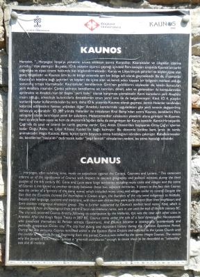
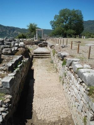
" ...Harpagos, after subduing, Ionia, make an expedition against the Carians, Caunians and Lycians... " This statement informs us of the significance of Caunus with respect to ancient geography and political relations during the third quarter of the 6th century B.C. Caria and Lycia were large territories including many cities and villages and the name of Caunus is mentioned as another territory between these two adjacent territories. It points to the fact that Caunus was the center of a territory of the same name, which included many cities and villages under its control. Despite the fact that the Cautions claimed for themselves a Cretan origin, the founders of the city were indigenous to Anatolia. Besides their language, customs and traditions, with their own deities they were quite distinct from their neighbours and from another indigenous Anatolian group. This is further supported by Caunus's earliest local name, Kbid, which is documented from archaeological finds and this local non-Hellenic name, was in use until the end of the 6th century B.C. The city was renamed Caunus directly following its colonization by the Hellenes, this was the case with other cities in Anatolia. After the King's Peace Treaty in 387 B.C., Caunus came under the rule of a local dynasty, the Hecatomnids, who presented themselves as Perian satraps (Governors). And Caunus became a strategically, economically and politically prosperous Carian city. The city has a long and important history during the Christian Byzantine Period. During the late antiquity, Caunus remained within the Eastern Rome Empire and adhered to the Lycian Church until the middle of Medieval Period. Beginning from this period, Caunus was called by the name: Hagia Caunus. The reason why the people of Caunus had almost a "greenish complexion" enough to cause them to be described as "unhealthy" was due to malaria.
Turkish:
Herodot, "...Harpagos İonya'yı yönetimi altına aldıktan sonra Karyalılar, Kaunoslular ve Likyalılar üzerine yürüdü..." diye yazmıştır. Bu pasaj, İÖ 6. yüzyılın üçünü çeyreǧi icindeki Pers savaşlar sırasında Kaunos'un tarihi coǧrafyası ve siyasi önemi hakkında bizi bilgilendirmektedir: Kary ve Likya berçok şehirleri ve köyleri içine alan geniş bölgelerdir ve Kaunos ismi bu iki bölge arasında ayrı bir bölge adı olarak geçmektedir. Bu da, o zamanlar Kaunos'un kendine baǧı şehirleri ve köyleri de içine alan ve kendi adını taşıyan bir bölgenin merkezi olduǧu sonucunu ortaya koymaktadır. Kaunoslular, dendilerinin Girt'ten geldiklerini söyleseler de, kentin kuruculari yerku Anadolu insanıdır, Çünkü yalnızca kendilerine ait tanrıları, dilleri, adet ve görenekleri ile komşularından ayrılmakta ve Anadolu'nun bir başka "yerli hakkı" olarak karşımıza çıkmaktadır. Kenti kuranların yerli Anadolu insanı olduǧu, arkeolojik buluntularla desteklenen onun yerel ismi ile de belgelenmiştir: Kbid İÖ 4 yüzyılın sonlarına kadar kullanımda kalan bu isim, İÖ 6 yüzyılda Kaunos olarak geçmesi kentin Helenler tarafından kolonize edilmesinin hemen ardıdan diğer Anadolu kentlerinde uyguladıkları gibi yerli isminin deǧiştirilmiş olmasıyla açıklanabilir. İÖ 387 yılında Helenler ile imzalanan Kral Barışi'ndan sonra Kaunos, kendilerin satraplar olarak tanımlayan yerel bin sülalenin, Hekatomnidler sülalesinin yönetimi altına girmiştir Ve Kaunos, hem stratejik hem siyasi ve hen de ekonomik açıdan daha da zenginleşen bir Karya kentidir. Kentin Hıristiyanlık Çaǧi'nda da uzun ve onemli bir tarihi geçmişi vardır. Geç Antik Dönem'den başlayarak Orta Çaǧ'ın içlerine kadar Doǧu Roma ve Likya Kilisesi Eyaleti'ne baǧlı kalıştır. Bu dönemle birlikte kent, artık iki isimle anılmaktadır: Hagia Kaunos Kent, bütün tarihi boyunca sıtma hastaliǧınin ıstırabını çekmiştir. Kabulenmeseler de, kendilerine "hastalıkılı" dedirtecek kadar "yeşil benizli" olmalarının nedeni, bu sıtma hastalıǧı olmalıdır.
Erected by Kültür ve Turizm Bakanlıǧı and Başkent Üniversitesi.
Topics. This historical marker is listed in this topic list: Settlements & Settlers.
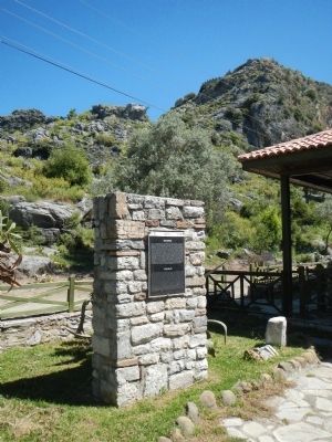
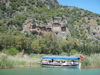
Location. 36° 49.371′ N, 28° 37.398′ E. Marker is near Çandir, Muǧla, in Köycegiz. Marker is on Isimsiz Yol. Access by road to Caunus is available from Köyceǧiz via Hamilköy and Sultananiye. However, it is much easier to take a water taxi from the river front in downtown Dalyan. Touch for map. Marker is in this post office area: Çandir, Muǧla 48800, Turkey. Touch for directions.
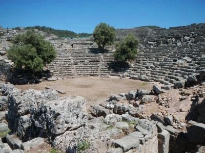
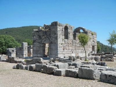
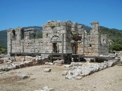
Other nearby markers. At least 4 other markers are within walking distance of this marker. Theater (approx. 0.3 kilometers away); Theater Fountain (approx. 0.3 kilometers away); The Domed Church (approx. 0.4 kilometers away); The Roman Bath (approx. 0.4 kilometers away).
Also see . . . Kaunos - Wikipedia. Kaunos was an important sea port, the history of which is supposed to date back till the 10th century BC. Because of the formation of İztuzu Beach and the silting of the former Bay of Dalyan (from approx. 200 BC onwards), Kaunos is now located about 8 km from the coast. (Submitted on June 10, 2015, by Barry Swackhamer of Brentwood, California.)
Credits. This page was last revised on February 1, 2022. It was originally submitted on June 10, 2015, by Barry Swackhamer of Brentwood, California. This page has been viewed 452 times since then and 5 times this year. Photos: 1, 2, 3, 4, 5, 6, 7, 8. submitted on June 10, 2015, by Barry Swackhamer of Brentwood, California. • Andrew Ruppenstein was the editor who published this page.
