Rogersville in Lauderdale County, Alabama — The American South (East South Central)
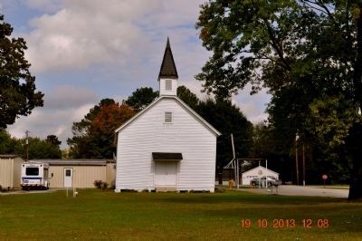
Rogersville Presbyterian Church in the U.S.A.
Inscription.
(side 1)
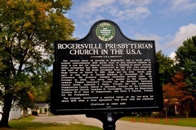
The earliest place of worship in Rogersville was a brush arbor located approximately 200 yards west of this historic location in what is now the old Liberty Cemetery. A building in which several faiths worshipped was later constructed on that site. This property was part of the 158 acres purchased from the U.S. Government by Hugh Porter on March 6, 1819. Hugh and his wife, Sarah, sold part of this land to George Simmons on December 21, 1842. Afterward, the property changed ownership several times. On October 12, 1848, two acres were deeded to the tenants in common: Thomas Davenport, Trustee for the Methodist Episcopal Presbyterian Church; Daniel W. Haraway, Trustee for the Continental Presbyterian Church; Jonathan M. Cunningham, Trustee for Benevolent Division No. 17 Sons of Temperance; and Peter F. Patrick, Trustee for the Freemasons.
The trustees constructed a meeting house on the two-acre lot about 1855 when trust agreement was made with the creditors.
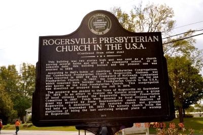
According to Hall's Index of American Presbyterian Congregations, the Cumberland Presbyterian Church in Rogersville, Alabama, was first reported in 1890 by the Presbytery of McGready, Cumberland Presbyterian Church. In 1907, the congregation split and the one which remained here became the Presbyterian Church in the U.S.A., also known as the First Presbyterian Church. This congregation was dissolved or dropped from the roll in 1974.
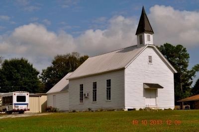
The property was deeded to the Town of Rogersville on September 20, 1975. In an effort to restore the historic property, a group of local citizens formed the Rogersville Historical Preservation Committee in 1997. Funds were donated by local citizens and a grant was secure by State Representative James Hamilton of Rogersville. A dedication of the restored church and grounds was held on September 28, 1997. The historic church holds the distinction of being the last surviving original place of worship in Rogersville.
Erected 2013 by East Lauderdale Historical Society.
Topics. This historical marker is listed in this topic list: Churches & Religion. A significant historical month for this entry is March 1807.
Location. 34° 49.613′ N, 87° 17.762′ W. Marker is in Rogersville, Alabama, in Lauderdale County. Marker is at the intersection of Lee Street (County Route 66) and Dement Street, on the right when
traveling west on Lee Street. Touch for map. Marker is in this post office area: Rogersville AL 35652, United States of America. Touch for directions.
Other nearby markers. At least 8 other markers are within 3 miles of this marker, measured as the crow flies. Heritage Park (about 300 feet away, measured in a direct line); Lamb’s Ferry Road (approx. 0.2 miles away); Lauderdale County High School 1912 (approx. 0.3 miles away); East End High School (approx. 1.1 miles away); Return of a Native (approx. 1.2 miles away); Samuel Burney: 1763-1849 Revolutionary War Veteran / Burneys Creek/First Creek Wheeler Lake (approx. 1.4 miles away); General Joseph Wheeler (approx. 2.2 miles away); Bettie Anne Highway (approx. 2˝ miles away). Touch for a list and map of all markers in Rogersville.
Credits. This page was last revised on June 16, 2016. It was originally submitted on October 21, 2013, by Sandra Hughes Tidwell of Killen, Alabama, USA. This page has been viewed 1,023 times since then and 40 times this year. Last updated on June 12, 2015, by J. Makali Bruton of Accra, Ghana. Photos: 1, 2, 3, 4, 5, 6. submitted on October 21, 2013, by Sandra Hughes Tidwell of Killen, Alabama, USA. • Bill Pfingsten was the editor who published this page.
