Rexburg in Madison County, Idaho — The American West (Mountains)
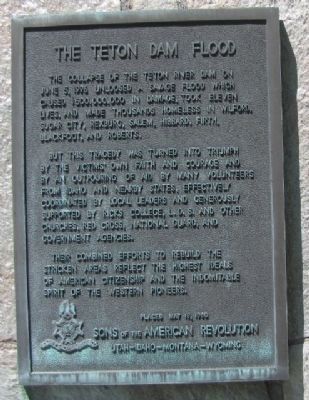
The Teton Dam Flood Marker
But this tragedy was turned into triumph by the victims’ own faith and courage and by of outpouring of aid by many volunteers from Idaho and nearby states, effectively coordinated by local leaders and generously supported by Ricks College, L.D.S. and other churches, Red Cross, National Guard, and the Government agencies.
Their combined efforts to rebuild the stricken areas reflect the highest ideals of American citizenship and the indomitable spirit of the Western pioneers
Placed May 19,1980
SONS OF THE AMERICAN REVOLUTION
UTAH-IDAHO-MONTANA-WYOMING
Erected 1980 by Sons of the American Revolution.
Topics and series. This historical marker is listed in this topic list: Disasters. In addition, it is included in the Sons of the American Revolution (SAR) series list. A significant historical date for this entry is May 19, 1861.
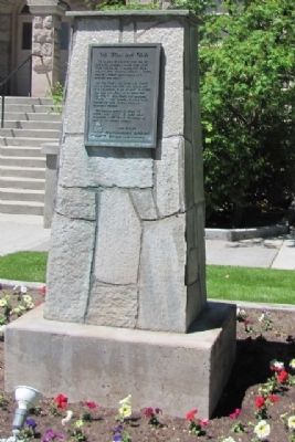
Location. 43° 49.642′ N, 111° 47.042′ W. Marker is in Rexburg, Idaho, in Madison County. Marker is on North Center Street. Marker is located on the grounds of the Teton Flood Museum/Rexburg Tabernacle building. Touch for map. Marker is at or near this postal address: 51 North Center, Rexburg ID 83440, United States of America. Touch for directions.
Other nearby markers. At least 8 other markers are within walking distance of this marker. In Honor of the Rexburg Stake Pioneers (here, next to this marker); Rexburg Tabernacle Centennial (here, next to this marker); Pioneer Park (here, next to this marker); Hitching Post (within shouting distance of this marker); The Tithing Barn Block (approx. 0.3 miles away); Rexburg's First School and Meetinghouse (approx. 0.4 miles away); Porter Park (approx. 0.4 miles away); Ricks College (approx. 0.4 miles away). Touch for a list and map of all markers in Rexburg.
Regarding The Teton Dam Flood Marker. There is a well done museum at the back of the Tabernacle building, admission $2.00 There is a film of the failure as well.
Credits. This page was last revised on November 11, 2016. It was originally submitted on June 13, 2015, by James R. Murray of Elkton, Florida. This page has been viewed 542 times since then and 23 times this year. Photos: 1, 2. submitted on June 13, 2015, by James R. Murray of Elkton, Florida. • Andrew Ruppenstein was the editor who published this page.
Editor’s want-list for this marker. A wide shot of the marker and its surroundings. • Can you help?

