Piermont in Rockland County, New York — The American Northeast (Mid-Atlantic)
Last Stop U.S.A.
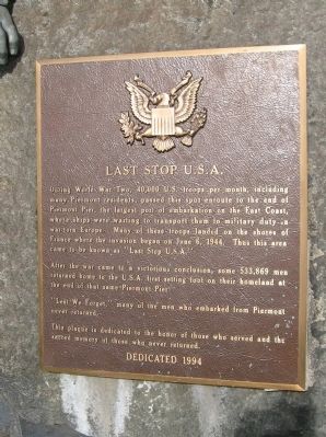
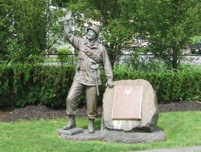
During World War Two, 40,000 U.S. troops per month, including many Piermont residents, passed this spot enroute to the end of Piermont Pier, the largest port of embarkation on the East Coast, where ships were waiting to transport them to military duty in war-torn Europe. Many of these troops landed on the shores of France where the invasion began on June 6, 1944. Thus this area came to be known as “Last Stop U.S.A.”
After the war came to a victorious conclusio, some 533,869 men returned home to the U.S.A. first setting foot on their homeland at the end of that same Piermont Pier.
“Lest We Forget,” many of the men who embarked from Piermont never returned.
This plaque is dedicated to the honor of those who served and the sacred memory of those who never returned.
Erected 1994.
Topics. This memorial is listed in this topic list: War, World II.
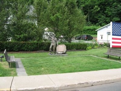
Location. 41° 2.301′ N, 73° 54.971′ W. Marker is in Piermont, New York, in Rockland County. Memorial is at the intersection of Piermont Avenue and Paradise Avenue, on the right when traveling south on Piermont Avenue. Touch for map. Marker is at or near this postal address: Piermont Avenue, Piermont NY 10968, United States of America. Touch for directions.
Other nearby markers. At least 8 other markers are within walking distance of this marker. Bridge Street Bridge Over The Sparkill Creek (about 300 feet away, measured in a direct line); Sneden House (about 400 feet away); Roll of Honor (approx. 0.2 miles away); Bogertown (approx. 0.2 miles away); The Flywheel: A Monument to Piermont's Industrial Past (approx. ¼ mile away); Piermont Station (approx. ¼ mile away); John G. Bell (approx. 0.6 miles away); Gravesite of General John Charles Frémont (approx. 0.6 miles away). Touch for a list and map of all markers in Piermont.
Credits. This page was last revised on June 16, 2016. It was originally submitted on June 15, 2015, by Michael Herrick of Southbury, Connecticut. This page has been viewed 576 times since then and 52 times this year. Photos: 1, 2, 3. submitted on June 15, 2015, by Michael Herrick of Southbury, Connecticut.


