Near Ledbetter in Fayette County, Texas — The American South (West South Central)
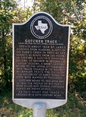
Gotcher Trace
(Also written Goacher, Gocher, Gotier, Goucher)
Gotcher moved to this area, and in 1836 six people of his family were killed and several captured during an Indian attack.
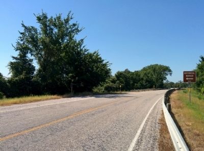
At this point the trace is crossed by a 20th century road.
Erected 1973 by Texas Historical Commission. (Marker Number 2232.)
Topics. This historical marker is listed in these topic lists: Roads & Vehicles • Settlements & Settlers • Wars, US Indian. A significant historical year for this entry is 1828.
Location. 30° 7.622′ N, 96° 47.529′ W. Marker is near Ledbetter, Texas, in Fayette County. Marker is on Farm to Market Road 1291, 1.7 miles south of U.S. 290, on the right when traveling north. Touch for map. Marker is in this post office area: Ledbetter TX 78946, United States of America. Touch for directions.
Other nearby markers. At least 8 other markers are within 8 miles of this marker, measured as the crow flies. Waldeck Cemetery (approx. 4.8 miles away); Waldeck Evangelical Lutheran Church (approx. 4.9 miles away); Bethlehem Church (approx. 7.1 miles away); Schiege Cigar Factory Manager's House (approx. 7.1 miles away); Moores Fort (approx. 7.1 miles away); Wandke House (approx. 7.1 miles away); Schiege House (approx. 7.1 miles away); Pochmann House (approx. 7.1 miles away).
Also see . . . Gotier's Trace article in Handbook of Texas. (Submitted on June 22, 2015, by Gregory Walker of La Grange, Texas.)
Credits. This page was last revised on June 16, 2016. It was originally submitted on June 22, 2015, by Gregory Walker of La Grange, Texas. This page has been viewed 1,391 times since then and 98 times this year. Photos: 1, 2. submitted on June 22, 2015, by Gregory Walker of La Grange, Texas. • Bernard Fisher was the editor who published this page.

