La Grange in Fayette County, Texas — The American South (West South Central)
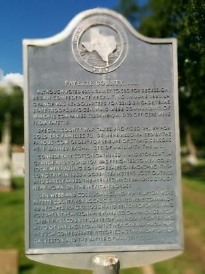
Fayette County, C.S.A.
Special county war taxes provided relief for soldiers' families. Funds were also raised by the famous "Cow Order" for seizure of strays. Censors here banned exchanges of mail with the U.S.
Confederate cotton gathered in and stored at La Grange and Round Top was freighted to Mexico by local men hauling 5 or more bales on each 3-months-long trip. In 1863 a dozen teamsters lost outfits and barely saved themselves when bandits struck near Roma, on the Mexican border.
Gen. Webb and Cols. John C. and Wm. F. Upton were Fayette County men. Local C.S.A. units were commanded by Capts. Ira G. Killough and Ben Shropshire, who fought in the Arizona-New Mexico campaign. Gen. Tom Green, first county surveyor, and Indian fighter and hero of San Jacinto and the Mexican war, had a part in such Confederate victories as the recapture of Galveston and the Battle of Mansfield, La.
Erected 1964 by State Historical Survey Committee. (Marker Number 1581.)
Topics. This historical marker is listed in this topic list: War, US Civil . A significant historical month for this entry is June 1861.
Location. 29° 54.625′ N, 96° 52.125′ W. Marker is in La Grange, Texas, in Fayette County. Marker is on North College Street north of East Travis Street (Business Texas Highway 71), on the right when traveling north. Touch for map. Marker is in this post office area: La Grange TX 78945, United States of America. Touch for directions.
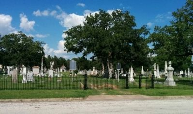
Other nearby markers. At least 8 other markers are within walking distance of this marker. Old City Cemetery (here, next to this marker); James Seaton Lester (a few steps from this marker); a different marker also named Fayette County (about 300 feet away, measured in a direct line); Yellow Fever Epidemic of 1867 (about 400 feet away); St. James Episcopal Church (approx. 0.3 miles away); Bradshaw-Killough House (approx. 0.4 miles away); Webb-Schneider House (approx. 0.4 miles away); Casino Hall (approx. half a mile away). Touch for a list and map of all markers in La Grange.
Credits. This page was last revised on June 16, 2016. It was originally submitted on June 22, 2015, by Gregory Walker of La Grange, Texas. This page has been viewed 511 times since then and 24 times this year. Photos: 1, 2. submitted on June 22, 2015, by Gregory Walker of La Grange, Texas. • Bernard Fisher was the editor who published this page.

