Town Creek in Lawrence County, Alabama — The American South (East South Central)
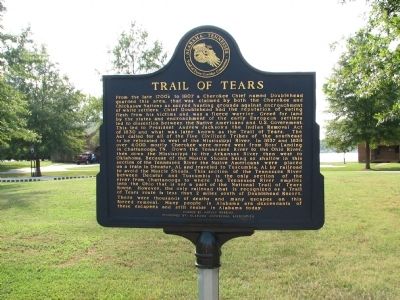
Trail of Tears
Chief Doublehead had the reputation of eating flesh from his victims and was a fierce warrior. Greed for land by the states and encroachment of the early European settlers led to dissention between the Native Americans and U.S. Government. This led to President Andrew Jackson's the Indian Removal Act of 1830 and what was later known as Trail of Tears. The Act called for all of the Five Civilized tribes of the Southeast to be relocated to west of the Mississippi River.
In 1837 and 1838 over 4,000 mostly Cherokee were moved west from Ross' Landing in Chattanooga, TN. Down the Tennessee River to the Ohio River, then down the Mississippi to the Arkansas River then west to Oklahoma. Because of the Muscle Shoals being so shallow in this section of the Tennessee River the native Americans were placed on a train in Decatur, AL and traveled to Tuscumbia, AL by railroad to avoid the Muscle Shoals. This section of the Tennessee River between Decatur and Tuscumbia is the only section of the river from Chattanooga to where the Tennessee River empties into the Ohio that is not a part of the National Trail of Tears Route. However, the only railroad that is recognized as a Trail of Tears route is less that 2 miles south of Doublehead Resort. There were thousands of deaths and many escapes on this forced removal. Many people in Alabama are descendants of these escapees and still reside in Alabama today.
Funded by Harvey Robbins
Sponsored by: Alabama Waterfowl Association
Erected by Alabama~Tennessee Trail of Tears Corridor Committee.
Topics and series. This historical marker is listed in this topic list: Native Americans. In addition, it is included in the Former U.S. Presidents: #07 Andrew Jackson, and the Trail of Tears series lists. A significant historical year for this entry is 1807.
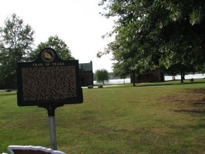
Location. 34° 46.471′ N, 87° 25.809′ W. Marker is in Town Creek, Alabama, in Lawrence County. Marker can be reached from Foster Mill Road (County Road 314) half a mile west of Wheeler Dam Road. Marker is on the grounds of the Doublehead Resort. Touch for map. Marker is at or near this postal address: 145 County Road 314, Town Creek AL 35672, United States of America. Touch for directions.
Other nearby markers. At least 8 other markers are within 6 miles of this marker, measured as the crow flies. The TVA System of Multi-purpose Dams (approx. 3.1 miles away); A Brief History (approx. 3.2 miles away); From Wheeler to the moon ... (approx. 3.2 miles away); Saunders~ Hall~ Goode Mansion (approx. 3.7 miles away); The Shaw Home (approx. 3.8 miles away); Wheeler Dam • Wheeler Reservoir/Locks (approx. 3.9 miles away); The Old Brick Presbyterian Church (approx. 5.4 miles away); Daniel White (approx. 5.7 miles away). Touch for a list and map of all markers in Town Creek.
Credits. This page was last revised on November 1, 2019. It was originally submitted on March 18, 2010, by Sandra Hughes Tidwell of Killen, Alabama, USA. This page has been viewed 2,204 times since then and 56 times this year. Last updated on June 23, 2015, by J. Makali Bruton of Accra, Ghana. Photos: 1. submitted on March 18, 2010, by Sandra Hughes Tidwell of Killen, Alabama, USA. 2, 3. submitted on March 22, 2010, by Sandra Hughes Tidwell of Killen, Alabama, USA. • Bill Pfingsten was the editor who published this page.


