Near Shiloh in McNairy County, Tennessee — The American South (East South Central)
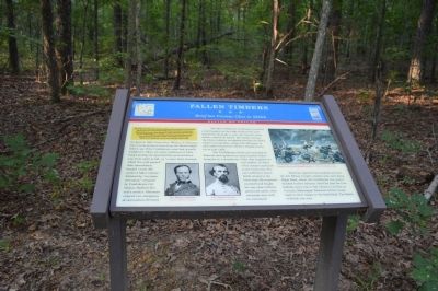
Fallen Timbers
Brief but Furious Close to Shiloh
— Battle of Shiloh —
After the February 1862 Union victories at Forts Henry and Donelson, Gen. Don Carlos Buell's army occupied Nashville while Gen. Ulysses S. Grant's army penetrated to Pittsburg Landing on the Tennessee River. Buell and Grant planned to attack the rail center of Corinth, Mississippi, but on April 6, Confederate Gen. Albert Sidney Johnston struck first. The Battle of Shiloh was a near Confederate victory the first day, although Johnston was killed. On the second day, Grant's counterattack succeeded, and the Confederates retreated to Corinth. Shiloh was the war's bloodiest battle to date, with almost 24,000 killed, wounded, or missing.
(main text)
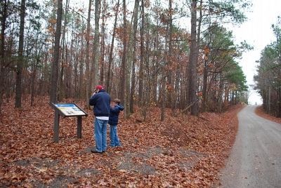
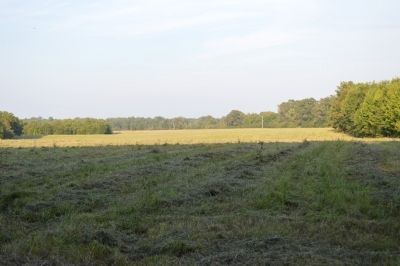
On April 8, 1862, Union Gen. William T. Sherman led a reconnaissance force from the Shiloh battlefield to see if the Confederate army had actually withdrawn. Here, six miles southwest of Pittsburg Landing, he described the ground before you, from right to left, as "a clear field, through which the road passed," then immediately beyond "some 200 yards of fallen timber," followed by "an extensive camp" occupied by Confederate Col. Nathan Bedford Forrest's cavalry. Sherman ordered two companies of skirmishers forward.
The 350 Confederate cavalrymen protected a field hospital on the ridge north of the road, beyond the drainage to your left. Forrest immediately ordered an attack. His charge overran the Union infantry struggling through the fallen timber, forcing them, along with Sherman, to seek safety behind the infantry brigade drawn up on your right.
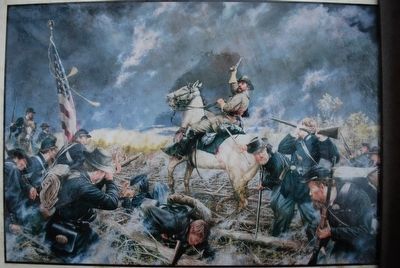
The Confederates killed and wounded 40 Federals and captured an equal number before being hit by a thunderous volley that emptied several saddles. In front of his troopers and close to the Union line, Forrest suffered a severe bullet wound in the lower back. He remained mounted and fought his way clear with his pistol and saber, then retreated west with his command.
Sherman captured the hospital and sent the 4th Illinois Cavalry another mile west along Ridge Road, where the Confederate rear guard blocked further advance. Satisfied that the Confederate army was in full retreat to its base at Corinth, Mississippi, Sherman led his troops back to their camps on the battlefield. The Battle of Shiloh was over.
(captions)
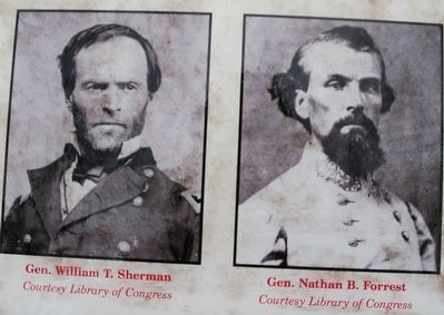
(bottom center) Gen. William T. Sherman; Gen. Nathan B. Forrest Courtesy Library of Congress
(top right) The wounded Col. Nathan Bedford Forrest fights his way out of the Federal encirclement at Fallen Timbers - Courtesy of artist Dan Nance
Erected by Tennessee Civil War Trails.
Topics and series. This historical marker is listed in this topic list: War, US Civil. In addition, it is included in the Tennessee Civil War Trails series list. A significant historical month for this entry is February 1862.
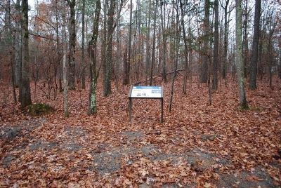
Location. 35° 6.192′ N, 88° 23.618′ W. Marker is near Shiloh, Tennessee, in McNairy County. Marker is on Harrison Road, half a mile west of Joe Dillon Road, on the right when traveling west. Touch for map. Marker is in this post office area: Michie TN 38357, United States of America. Touch for directions.
Other nearby markers. At least 8 other markers are within 2 miles of this marker, measured as the crow flies. C.S. Reserve Corps, Army of the Mississippi (approx. one mile away); Johnston's Last Bivouac (approx. one mile away); Stephens' Brigade (approx. 1.1 miles away); C.S. First Corps, Army of the Mississippi (approx. 1.2 miles away); C.S. Johnson's (1st) Brigade (approx. 1.2 miles away); Russell's Brigade (approx. 1.2 miles away); C.S. Stewart's (2nd) Brigade (approx. 1.4 miles away); C.S. Army of the Mississippi (approx. 1˝ miles away). Touch for a list and map of all markers in Shiloh.
Credits. This page was last revised on June 16, 2016. It was originally submitted on June 28, 2015, by Phillip Knecht of Holly Springs, Mississippi. This page has been viewed 1,631 times since then and 68 times this year. Photos: 1. submitted on June 28, 2015, by Phillip Knecht of Holly Springs, Mississippi. 2, 3, 4, 5. submitted on December 3, 2015, by Brandon Fletcher of Chattanooga, Tennessee. 6. submitted on June 28, 2015, by Phillip Knecht of Holly Springs, Mississippi. • Bernard Fisher was the editor who published this page.
