East Bradford Township near West Chester in Chester County, Pennsylvania — The American Northeast (Mid-Atlantic)
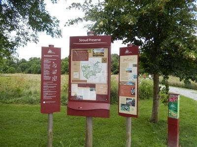
Stroud Preserve
This nature preserve is one of more than 40 owned and managed by Natural Lands Trust, a non-profit conservation organization serving eastern Pennsylvania and southern New Jersey.
Since 1953, we’ve been building an extensive network of preserves that range in size from a few acres to several thousand. Together they represent the diverse landscapes that are essential to our region’s environment and quality of life.
We hope you enjoy your visit and invite you to explore our other preserves. Learn more at www.natlands.org/preserves.
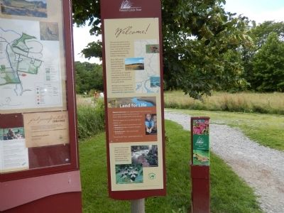
Lands for Life
Natural Lands Trust is the region’s largest land conservation organization, saving thousands of acres of forests, fields, wetlands, and streams each year. With the support of our members and other partners, we:
*Save natural areas for generations to come.
*Steward landscapes to support a healthy environment.
*Connect people to the natural world around them.
Natural Lands Trust…preserving land for life.
Topics. This historical marker is listed in these topic lists: Environment • Horticulture & Forestry. A significant historical year for this entry is 1953.
Location. 39° 57.162′ N, 75° 38.862′ W. Marker is near West Chester, Pennsylvania, in Chester County. It is in East Bradford Township. Marker is on North Creek Road. Touch for map. Marker is at or near this postal address: 435 N Creek Rd, West Chester PA 19382, United States of America. Touch for directions.
Other nearby markers. At least 8 other markers are within 2 miles of this marker, measured as the crow flies. Down by the Water’s Edge (within shouting distance of this marker); 1107 W. Strasburg Road (approx. 0.7 miles away); Gilbert Cope (approx. 0.7 miles away); Jefferis Ford (approx. 1.1 miles away); Battle of the Brandywine (approx. 1.1 miles away); a different marker also named Jefferis Ford (approx. 1.1 miles away); The Worth / Jefferis Rural Historic District (approx. 1.1 miles away); Site of the Star Tavern (approx. 1.6 miles away). Touch for a list and map of all markers in West Chester.
Credits. This page was last revised on February 7, 2023. It was originally submitted on July 4, 2015, by Don Morfe of Baltimore, Maryland. This page has been viewed 384 times since then and 16 times this year. Last updated on September 30, 2021, by Carl Gordon Moore Jr. of North East, Maryland. Photos: 1, 2. submitted on July 4, 2015, by Don Morfe of Baltimore, Maryland. • J. Makali Bruton was the editor who published this page.

