Brusly in West Baton Rouge Parish, Louisiana — The American South (West South Central)
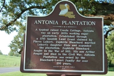
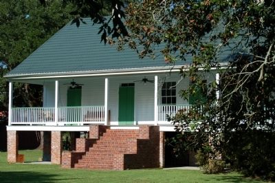
Antonia Plantation
Erected 2008 by The Becnel Family.
Topics. This historical marker is listed in these topic lists: Agriculture • Architecture • Settlements & Settlers. A significant historical year for this entry is 1793.
Location. 30° 24.185′ N, 91° 13.291′ W. Marker is in Brusly, Louisiana, in West Baton Rouge Parish. Marker is at the intersection of South River Road (State Highway 988) and Antonio Road, on the right when traveling south on South River Road. Touch for map. Marker is in this post office area: Port Allen LA 70767, United States of America. Touch for directions.
Other nearby markers. At least 8 other markers are within 2 miles of this marker, measured as the crow flies. Sandbar Plantation House (approx. half a mile away); Historic Cinclare Plantation (approx. 0.9 miles away); Original Brusly High School (approx. 1.1 miles away); Molaisonville / St. James Square (approx. 1.4 miles away); Union Baptist Church (approx. 1.4 miles away); St. John the Baptist Catholic Church/Eglise Catholique St Jean Baptiste (approx. 1˝ miles away); St. John the Baptist Catholic Cemetery (approx. 1˝ miles away); Brusly, Louisiana (approx. 1.8 miles away). Touch for a list and map of all markers in Brusly.
Credits. This page was last revised on September 16, 2023. It was originally submitted on July 5, 2015. This page has been viewed 439 times since then and 35 times this year. Photos: 1, 2. submitted on July 5, 2015. • Bernard Fisher was the editor who published this page.
Editor’s want-list for this marker. A wide view photo of the marker and the surrounding area in context. • Can you help?

