Near Sheffield in Crockett County, Texas — The American South (West South Central)
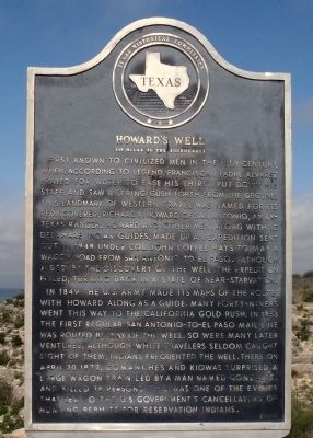
Howard's Well
(19 Miles to the Southeast)
In 1849 the US Army made its maps of the route, with Howard along as a guide. Many forty-niners went this way to the California gold rush. In 1853 the first regular San Antonio to El Paso mail line was routed by way of the well. So were many later ventures. Although white travelers seldom caught sight of them, Indians frequented the well. There on April 20, 1872, Comanches and Kiowas surprised a large wagon train led by a man named Gonzales, and killed 16 persons. This was one of the events that led to the US Government's cancellation of hunting permits for reservation Indians.
Erected 1968 by Texas Historical Commission. (Marker Number 2587.)
Topics and series. This historical marker is listed in these topic lists: Exploration • Industry & Commerce • Settlements & Settlers. In addition, it is included in the San Antonio-El Paso Road series list. A significant historical month for this entry is April 1590.
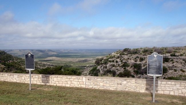
Location. 30° 40.703′ N, 101° 40.38′ W. Marker is near Sheffield, Texas, in Crockett County. Marker is on State Highway 290, 8.8 miles south of Interstate 10, on the left when traveling west. This marker was originally placed at the Fort Lancaster Visitor's Center. It was missing for several years and has now been installed at the State Hwy 280 TXDOT picnic area overlook. Touch for map. Marker is in this post office area: Sheffield TX 79781, United States of America. Touch for directions.
Other nearby markers. At least 8 other markers are within 2 miles of this marker, measured as the crow flies. The Chihuahua Trail and Escondido Water Hole (here, next to this marker); Old Government Road (a few steps from this marker); Fort Lancaster Cemetery (approx. 1˝ miles away); Hospital (approx. 1.6 miles away); Officer's Quarters (approx. 1.6 miles away); Commanding Officer's Quarters (approx. 1.6 miles away); Commissary (approx. 1.6 miles away); Ruins of Fort Lancaster (approx. 1.6 miles away). Touch for a list and map of all markers in Sheffield.
Regarding Howard's Well. The actual site of Howard's Well is miles away to the east, near Ozona.
Credits. This page was last revised on June 16, 2016. It was originally submitted on July 5, 2015, by William F Haenn of Fort Clark (Brackettville), Texas. This page has been viewed 555 times since then and 26 times this year. Photos: 1, 2. submitted on July 5, 2015, by William F Haenn of Fort Clark (Brackettville), Texas. • Bernard Fisher was the editor who published this page.

