Varied Industries Building
1903
— Architects: Thomas Bast • Contractors: Heckert & Ricketts, John Colaflower & Dean Brothers —
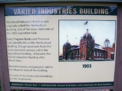
The Varied Industries Building was originally called the Horticulture Building, one of the most elaborate of the 1903 exposition halls.
Early Program Books and Premium Lists identify this as the Horticulture Building, though postcards from the early twentieth century call it the Agriculture Building. It became the Varied Industries Building after World War I.
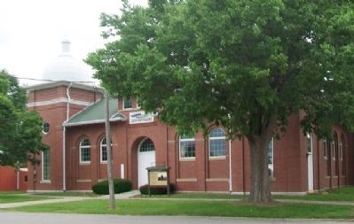
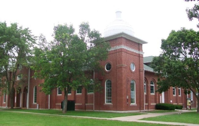
Rounded domes and parapets add to the Moorish look of the building.
It is one of the three oldest buildings on the fairgrounds.
Erected by Missouri State Fair Commission.
Topics. This historical marker is listed in these topic lists: Agriculture • Architecture • Horticulture & Forestry • Industry & Commerce. A significant historical year for this entry is 1903.
Location. 38° 41.499′ N, 93° 15.463′ W. Marker is in Sedalia, Missouri, in Pettis County. Marker and building are on the Missouri State Fairgrounds. Touch for map. Marker is at or near this postal address: 2503 West 16th Street, Sedalia MO 65301, United States of America. Touch for directions.
Other nearby markers. At least 8 other markers are within walking distance of this marker. Old Smokie Frisco Engine (within shouting distance of this marker); The Merci Boxcar (about 400 feet away, measured in a direct line); Commercial Building (about 400 feet away); Poultry & Rabbit Building
Also see . . .
1. Missouri State Fairgrounds Historic District. National Register of Historic Places Registration Form (Submitted on July 5, 2015, by William Fischer, Jr. of Scranton, Pennsylvania.)
2. Missouri State Fair History. Fair website entry (Submitted on July 5, 2015, by William Fischer, Jr. of Scranton, Pennsylvania.)
Credits. This page was last revised on June 5, 2022. It was originally submitted on July 5, 2015, by William Fischer, Jr. of Scranton, Pennsylvania. This page has been viewed 286 times since then and 18 times this year. Photos: 1, 2, 3. submitted on July 5, 2015, by William Fischer, Jr. of Scranton, Pennsylvania.


