North Bloomfield in Nevada County, California — The American West (Pacific Coastal)
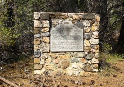
North Bloomfield Mining and Gravel Company
Inscription.
This was a major hydraulic operation in California. Its vast system of canals and flumes using a drainage tunnel 7800 feet long was termed a feat of engineering skill. It was the principal defendant in an anti-debris lawsuit settled by the Sawyer decision in 1884. Judge Lorenzo Sawyer’s famous decision created control that virtually ended hydraulic mining in California.
Erected 1972 by California State Department of Parks and Recreation. (Marker Number 852.)
Topics and series. This historical marker is listed in this topic list: Industry & Commerce. In addition, it is included in the California Historical Landmarks series list.
Location. 39° 22.123′ N, 120° 54.813′ W. Marker is in North Bloomfield, California, in Nevada County. Marker is on North Bloomfield Road, on the right when traveling west. Touch for map. Marker is in this post office area: Nevada City CA 95959, United States of America. Touch for directions.
Other nearby markers. At least 8 other markers are within 2 miles of this marker, measured as the crow flies. North Bloomfield School (approx. 0.4 miles away); North Bloomfield Drain Tunnel (approx. half a mile away); St. Columncille's Church (approx. half a mile away); Alvin Stevens Trivelpiece (approx. 0.6 miles away); Shoot (Chute) Hill (approx. 0.7 miles away); Malakoff Diggins Clampicnic Area (approx. 0.7 miles away); Giant (approx. ¾ mile away); Site of Lake City (approx. 1.8 miles away).
More about this marker. The monument is on the right side of the Diggins trailhead parking lot, set back amongst the trees.
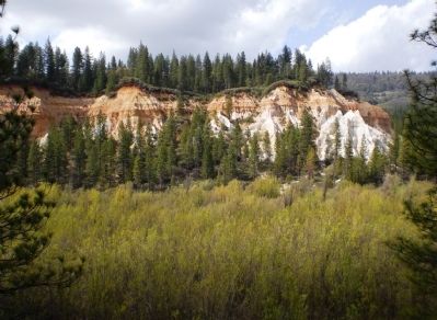
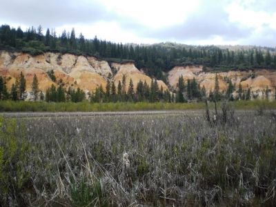
Regarding North Bloomfield Mining and Gravel Company. The Malakoff Diggins open pit mine site is approximately 1.25 miles long and 0.5 miles wide, with a scenic loop trail that circles the perimeter of the mine pit floor.
Related marker. Click here for another marker that is related to this marker.
Also see . . .
1. Malakoff Diggins State Historical Park website. (Submitted on June 23, 2008, by Andrew Ruppenstein of Lamorinda, California.)
2. North Bloomfield, California. "North Bloomfield and the Malakoff Mine became a ghost when hydraulic mining was brought to an end in 1884 by a suit filed by Sacramento valley farmers. Debris, silt, and millions of gallons of water used daily by the mine caused extensive flooding in Marysville and Yuba City. San Francisco bay was estimated to be filling with silt at a
rate of one foot per year." (Submitted on June 24, 2008, by Kevin W. of Stafford, Virginia.)

Photographed By Andrew Ruppenstein, April 18, 2008
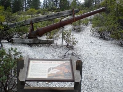
4. Hydraulic Monitor
The hydraulic monitor was essentially a large nozzle, or water cannon, as it were, that shot out large volumes of water at extremely high pressures to wash away the gold ore-bearing hillsides. The ore was collected in giant sluices and then processed to extract the gold.
Credits. This page was last revised on January 5, 2020. It was originally submitted on June 23, 2008, by Andrew Ruppenstein of Lamorinda, California. This page has been viewed 3,330 times since then and 24 times this year. Photos: 1, 2, 3, 4. submitted on June 23, 2008, by Andrew Ruppenstein of Lamorinda, California. • Kevin W. was the editor who published this page.


