Marker Logo HMdb.org THE HISTORICAL
MARKER DATABASE
“Bite-Size Bits of Local, National, and Global History”
Wilmington in Los Angeles in Los Angeles County, California — The American West (Pacific Coastal)
 

Drum Barracks


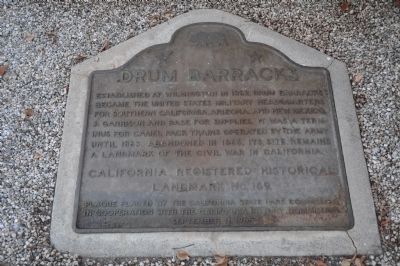
Drum Barracks Marker image. Click for full size.
Photographed By Michael Kindig, September 25, 2010
1. Drum Barracks Marker
Inscription. Established at Wilmington in 1862, Drum Barracks became the United States military headquarters for Southern California, Arizona, and New Mexico. A garrison and base for supplies, it was a terminus for camel pack trains operated by the army until 1863. Abandoned in 1866, its site remains a landmark of the Civil War in California.
 
Erected 1965 by California State Park Commission in cooperation with the California History Commission. (Marker Number 169.)
 
Topics and series. This historical marker is listed in these topic lists: AnimalsNotable PlacesWar, US Civil. In addition, it is included in the California Historical Landmarks series list. A significant historical year for this entry is 1862.
 
Location. 33° 47.067′ N, 118° 15.447′ W. Marker is in Los Angeles, California, in Los Angeles County. It is in Wilmington. Marker can be reached from Cary Avenue north of East Opp Street, on the left when traveling north. Marker is located below the porch on the east (Cary Avenue) side of the Drum Barracks Museum whose main entrance is off North Banning Boulevard. Touch for map. Marker is at or near this postal address: 1052 North Banning Boulevard, Wilmington CA 90744, United States of America. Touch for directions.
 
Other nearby markers. At least 8 other markers are within one mile of this marker, measured as the crow flies. A different marker also named Drum Barracks (a few steps from
Paid Advertisement
Click on the ad for more information.
Please report objectionable advertising to the Editor.
Click or scan to see
this page online
this marker); Powder Magazine at the Drum Barracks (about 800 feet away, measured in a direct line); Banning Residence Museum (approx. 0.3 miles away); Memory Chapel (approx. 0.4 miles away); a different marker also named Banning Residence Museum (approx. half a mile away); Wilmington Cemetery (approx. 0.6 miles away); St. John’s Episcopal Church (approx. one mile away); Der Wienerschnitzel (approx. one mile away). Touch for a list and map of all markers in Los Angeles.
 
Related markers. Click here for a list of markers that are related to this marker.
 
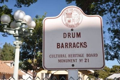
Drum Barracks Marker image. Click for full size.
Photographed By Michael Kindig, September 25, 2010
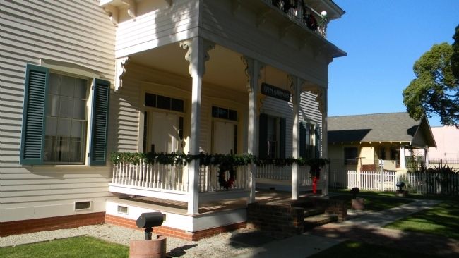
2. Drum Barracks Marker
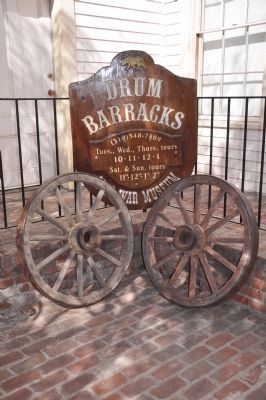
Drum Barracks, viewed from Cary Street image. Click for full size.
Photographed By Richard E. Miller, December 7, 2011
3. Drum Barracks, viewed from Cary Street
Marker visible, lower middle, on the ground in the shadow of the brick porch steps.
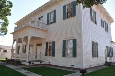
Drum Barracks image. Click for full size.
Photographed By Michael Kindig, September 25, 2010
4. Drum Barracks
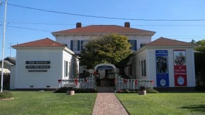
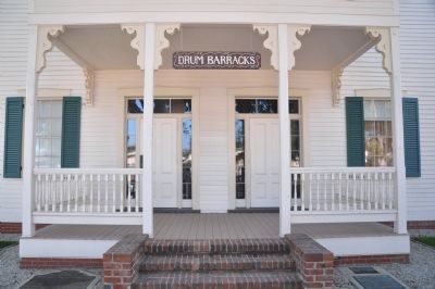
Drum Barracks Museum - view from N. Banning Blvd. image. Click for full size.
Photographed By Richard E. Miller, December 7, 2011
5. Drum Barracks Museum - view from N. Banning Blvd.
Drum Barracks image. Click for full size.
Photographed By Michael Kindig, September 25, 2010
6. Drum Barracks
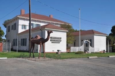
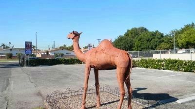
The Drum Barracks Camel, commemorating the U.S. Army's experimental "camel corps" image. Click for full size.
Photographed By Richard E. Miller, December 7, 2011
7. The Drum Barracks Camel, commemorating the U.S. Army's experimental "camel corps"
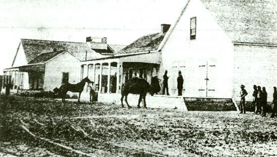
The only known photograph of an Army camel. Government Depot near Banning's Wharf. image. Click for full size.
Photographed By Http://www.forttejon.org/camels.html
8. The only known photograph of an Army camel. Government Depot near Banning's Wharf.
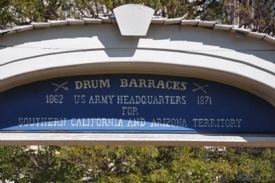
Drum Barracks image. Click for full size.
Photographed By Michael Kindig, September 25, 2010
9. Drum Barracks
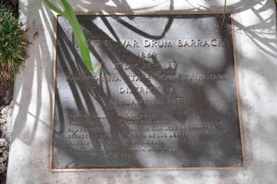
Civil War Drum Barracks - 1862 image. Click for full size.
Photographed By Michael Kindig, September 25, 2010
10. Civil War Drum Barracks - 1862
Dedicated by California State Society NSDAR District IX January 15, 1978.
Drum Barracks image. Click for full size.
Photographed By Michael Kindig, September 25, 2010
11. Drum Barracks
Drum Barracks image. Click for full size.
Photographed By Michael Kindig, September 25, 2010
12. Drum Barracks
 
 
Credits. This page was last revised on February 7, 2023. It was originally submitted on December 26, 2011, by Michael Kindig of Elk Grove, California. This page has been viewed 1,035 times since then and 25 times this year. Last updated on July 7, 2015, by Richard E. Miller of Oxon Hill, Maryland. Photos:   1. submitted on December 26, 2011, by Michael Kindig of Elk Grove, California.   2. submitted on December 27, 2011, by Michael Kindig of Elk Grove, California.   3. submitted on January 7, 2012, by Richard E. Miller of Oxon Hill, Maryland.   4. submitted on December 27, 2011, by Michael Kindig of Elk Grove, California.   5. submitted on January 7, 2012, by Richard E. Miller of Oxon Hill, Maryland.   6. submitted on December 27, 2011, by Michael Kindig of Elk Grove, California.   7, 8. submitted on January 7, 2012, by Richard E. Miller of Oxon Hill, Maryland.   9, 10, 11, 12. submitted on December 27, 2011, by Michael Kindig of Elk Grove, California. • Andrew Ruppenstein was the editor who published this page.
Share this page.  
Share on Tumblr
m=85152

CeraNet Cloud Computing sponsors the Historical Marker Database.
This website earns income from purchases you make after using our links to Amazon.com. We appreciate your support.
Paid Advertisement
Apr. 25, 2024