Clinton Township in Macomb County, Michigan — The American Midwest (Great Lakes)
Moravian Road
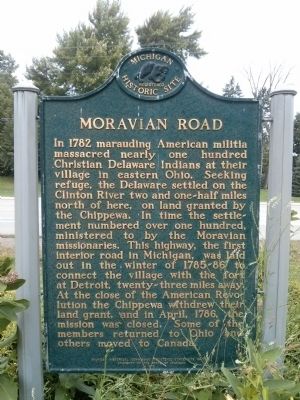
In 1782 marauding American militia massacred nearly one hundred Christian Delaware Indians at their village in eastern Ohio. Seeking refuge, the Delaware settled on the Clinton River two and one-half miles north of here, on land granted by the Chippewa. In time the settlement numbered over one hundred, ministered to by the Moravian missionaries. This highway, the first interior road in Michigan, was laid out in the winter of 1785-86 to connect the village with the fort at Detroit, twenty-three miles away. At the close of the American Revolution the Chippewa withdrew their land grant, and in April, 1786, the mission was closed. Some of the members returned to Ohio and others moved to Canada.
Erected 1972 by Michigan Historical Commission. (Marker Number S142.)
Topics and series. This historical marker is listed in these topic lists: Native Americans • Roads & Vehicles. In addition, it is included in the Michigan Historical Commission series list. A significant historical month for this entry is April 1786.
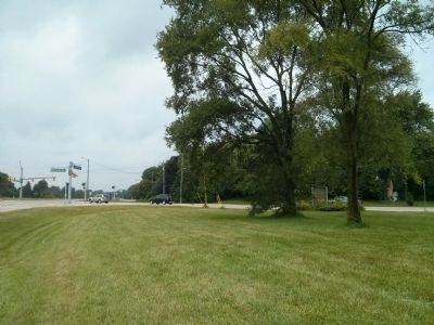
Location. 42° 34.137′ N, 82° 56.288′ W. Marker is in Clinton Township, Michigan, in Macomb County. Marker is at the intersection of Metropolitan Parkway and Moravian Drive, on the right when traveling west on Metropolitan Parkway. Touch for map . Marker is in this post office area: Clinton Township MI 48036, United States of America. Touch for directions.
Other nearby markers. At least 8 other markers are within 4 miles of this marker, measured as the crow flies. St. John Lutheran Church and Schools (approx. 2.3 miles away); Fire Apparatus Bell (approx. 2.6 miles away); Baumgartner House (approx. 2.6 miles away); The Baumgartner House 1875 (approx. 2.6 miles away); Clinton Grove Cemetery (approx. 2.8 miles away); Thomas Edison (approx. 3.1 miles away); Grand Trunk Western Railroad, Mount Clemens Station (approx. 3.1 miles away); Grace Episcopal Church (approx. 3.4 miles away).
Related marker. Click here for another marker that is related to this marker. Gnadenhutten / The Gnadenhutten Massacre "A Day of Shame". The massacre mentioned on this historical marker is the Gnadenhutten Massacre, which has its own historical marker.
Credits. This page was last revised on February 7, 2023. It was originally submitted on July 17, 2015, by Joel Seewald of Madison Heights, Michigan. This page has been viewed 1,496 times since then and 137 times this year. Photos: 1, 2. submitted on July 17, 2015, by Joel Seewald of Madison Heights, Michigan. • Andrew Ruppenstein was the editor who published this page.

