Morgan City in St. Mary Parish, Louisiana — The American South (West South Central)
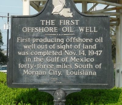
First Offshore Oil Well
First producing offshore oil
well out of sight of land
was completed Nov. 14, 1947
in the Gulf of Mexico
forty-three miles South of
Morgan City, Louisiana
25th Offshore Anniversary, Inc.
Chamber of Commerce
Morgan City, Berwick, Patterson Area
Erected 1972 by 25th Offshore Anniversary, Inc.
Topics. This historical marker is listed in these topic lists: Bridges & Viaducts • Industry & Commerce • Natural Resources • Waterways & Vessels. A significant historical date for this entry is October 14, 1927.
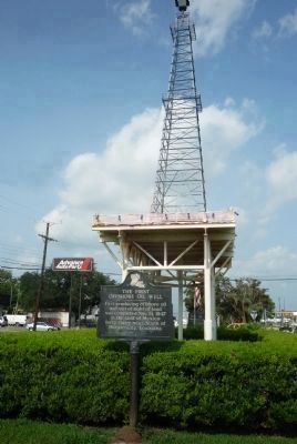
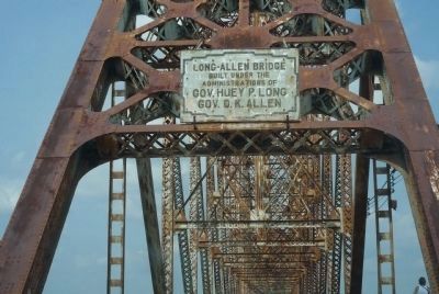
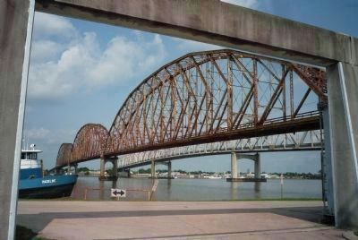
Location. 29° 42.022′ N, 91° 12.305′ W. Marker is in Morgan City, Louisiana, in St. Mary Parish. Marker is on Brashear Avenue (State Highway 182) west of 5th Street, in the median. Marker is five blocks east of the historic Long-Allen Bridge over Berwick Bay on the Atchafalaya River. Touch for map. Marker is in this post office area: Morgan City LA 70380, United States of America. Touch for directions.
Other nearby markers. At least 8 other markers are within walking distance of this marker. The Governor Jared Young Sanders Memorial Monument (approx. 0.3 miles away); Civil War Years (approx. 0.4 miles away); Charles Morgan (approx. 0.4 miles away); Morgan City Floodwalls (approx. half a mile away); Atchafalaya River (approx. half a mile away); Sacred Heart Of Jesus Church (approx. half a mile away); Fort Star (approx. 0.6 miles away); Mount Pilgrim Baptist Church (approx. 0.6 miles away). Touch for a list and map of all markers in Morgan City.
Also see . . .
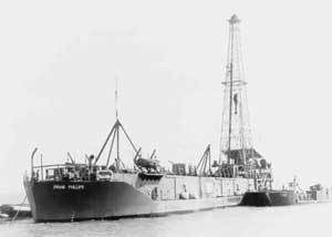
1. Oil Platform. ...In early 1947 Superior Oil erected a drilling/production platform in 20 ft of water some 18 miles[vague] off Vermilion Parish, Louisiana. But it was Kerr-McGee Oil Industries (now Anadarko Petroleum Corporation), as operator for partners Phillips Petroleum (Conoco Phillips) and Stanolind Oil & Gas (BP), that completed its historic Ship Shoal Block 32 well in October 1947, months before Superior actually drilled a discovery from their Vermilion platform farther offshore. In any case, that made Kerr-McGee's well the first oil discovery drilled out of sight of land. ... (Submitted on September 24, 2010, by Richard E. Miller of Oxon Hill, Maryland.)
2. U.S. Route 90 in Louisiana. (Submitted on September 24, 2010, by Richard E. Miller of Oxon Hill, Maryland.)
Additional keywords. Blue Star Memorial Highway; Berwick Bay; Ship Shoal
Block 32; Frank Phillips; "Rig 15"; Atchafalaya River Delta/Basin.
Credits. This page was last revised on April 20, 2017. It was originally submitted on September 23, 2010, by Richard E. Miller of Oxon Hill, Maryland. This page has been viewed 3,828 times since then and 63 times this year. Last updated on July 18, 2015. Photos: 1, 2. submitted on September 23, 2010, by Richard E. Miller of Oxon Hill, Maryland. 3. submitted on September 24, 2010, by Richard E. Miller of Oxon Hill, Maryland. 4. submitted on September 23, 2010, by Richard E. Miller of Oxon Hill, Maryland. 5. submitted on September 24, 2010, by Richard E. Miller of Oxon Hill, Maryland. • Bernard Fisher was the editor who published this page.
