Red House in Putnam County, West Virginia — The American South (Appalachia)
Red House Shoals / Civil War Action
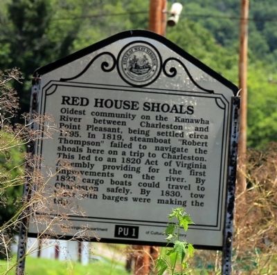
Red House Shoals. Oldest community on the Kanawha River between Charleston and Point Pleasant, being settled circa 1795. In 1819, steamboat “Robert Thompson” failed to navigate the shoals here on a trip to Charleston. This led to an 1820 Act of Virginia Assembly providing for the first improvements on the river. By 1823 cargo boats could travel to Charleston safely. By 1830, tow boats with barges were making the trip.
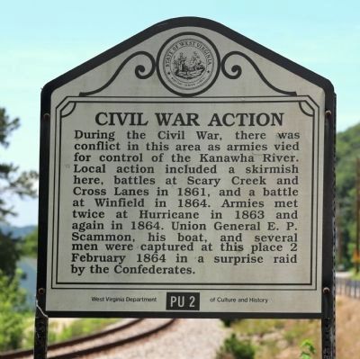
Civil War Action. During the Civil War, there was conflict in this area as armies vied for control of the Kanawha River. Local action included a skirmish here, battles at Scary Creek and Cross Lanes in 1861, and a battle at Winfield in 1864. Armies met twice at Hurricane in 1863 and again in 1864. Union General E. P. Scammon, his boat, and several men were captured at this place 2 February 1864 in a surprise raid by the Confederates.
Erected by West Virginia Department of Culture and History. (Marker Number PU 1 PU 2.)
Topics and series. This historical marker is listed in these topic lists: War, US Civil • Waterways & Vessels. In addition, it is included in the West Virginia Archives and History series list. A significant historical date for this entry is February 2, 1864.
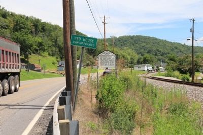
Location. 38° 32.748′ N, 81° 53.25′ W. Marker is in Red House, West Virginia, in Putnam County. Marker is at the intersection of Charleston Road (U.S. 35) and Frazier Lane, on the right when traveling south on Charleston Road. It is between the road and the railroad tracks. Touch for map. Marker is in this post office area: Red House WV 25168, United States of America. Touch for directions.
Other nearby markers. At least 8 other markers are within 2 miles of this marker, measured as the crow flies. Winfield / Battle of Winfield (approx. 0.9 miles away); Putnam County War Memorial (approx. 0.9 miles away); The Civil War in Putnam County (approx. 0.9 miles away); Historic Hoge House (approx. 0.9 miles away); Coal Mining in Putnam County (approx. 2 miles away); A Park for the Coal Miner (approx. 2 miles away); Andrew & Charles Lewis March (approx. 2 miles away); George Washington (approx. 2 miles away).
Also see . . . Red House Shoal. “Passage became easier when the chute was blasted, but because of a bend in the river just upstream and the swiftness of the current passing through the chute, Red House remained difficult until the high-lift locks and dams were built in the 1930s.” (Submitted on July 18, 2015.)
Credits. This page was last revised on June 16, 2016. It was originally submitted on July 18, 2015, by J. J. Prats of Powell, Ohio. This page has been viewed 873 times since then and 51 times this year. Photos: 1, 2, 3. submitted on July 18, 2015, by J. J. Prats of Powell, Ohio.


